Skip Links

USGS - science for a changing world

Scientific Investigations Map 3317

Lidar-Revised Geologic Map of the Poverty Bay 7.5' Quadrangle, King and Pierce Counties, Washington

By Rowland W. Tabor, Derek B. Booth, and Kathy Goetz Troost

Thumbnail of and link to SIM 3317 map PDF (105.2 MB)Introduction

For this map, we interpreted a 6-ft-resolution lidar digital elevation model combined with the geology depicted on the Geologic Map of the Poverty Bay 7.5' Quadrangle, King and Pierce Counties, Washington (Booth and others, 2004b). The authors of the 2004 map described, interpreted, and located the geology on the 1:24,000-scale topographic map of the Poverty Bay 7.5' quadrangle.

The topographic map, published in 1997 but compiled in 1957, includes planimetry derived from 1990 imagery and 20-ft contours, nominal horizontal resolution of 40 ft (12 m), and nominal vertical accuracy of 10 ft (3 m). Similar to many surficial geologic maps, much of the geology in Booth and others (2004b) was interpreted from landforms portrayed on the topographic map.

In 2003, the Puget Sound Lidar Consortium obtained a lidar-derived digital elevation model (DEM) for the Puget Sound region including all of the Poverty Bay 7.5' quadrangle. For a brief description of lidar (LIght Detection And Ranging) and this data acquisition program, see Haugerud and others (2003). This new DEM has a horizontal resolution and accuracy of 6 ft (2 m) and vertical accuracy of approximately 1 ft (0.3 m). The greater resolution and accuracy of the lidar DEM have facilitated a new interpretation of the geology, especially the distribution and relative age of some surficial deposits.

First posted November 14, 2014

  • Map; 2-view PDF (15.6 MB)
    The map PDF shows two views: the opening view shows the complete map; the second view shows the map without the unit colors to emphasize the lidar base.
  • Pamphlet PDF (263 kB)
    Pamphlet to accompany SIM 3317 map

This publication is online only

For additional information, contact:
GMEG staff, Geology, Minerals, Energy, & Geophysics Science Center
U.S. Geological Survey
345 Middlefield Road
Menlo Park, CA 94025-3591
http://geomaps.wr.usgs.gov/gmeg/

Part or all of this report is presented in Portable Document Format (PDF). For best results viewing and printing PDF documents, it is recommended that you download the documents to your computer and open them with Adobe Reader. PDF documents opened from your browser may not display or print as intended. Download the latest version of Adobe Reader, free of charge.


Suggested citation:

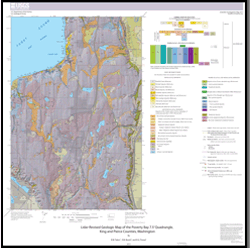
Tabor, R.W., Booth, D.B., and Troost, K.G., 2014, Lidar-revised geologic map of the Poverty Bay 7.5' quadrangle, King and Pierce Counties, Washington: U.S. Geological Survey Scientific Investigations Map 3317, 22 p., scale 1:24,000, https://dx.doi.org/10.3133/sim3317.

ISSN 2329-132X (online)


Accessibility FOIA Privacy Policies and Notices

Take Pride in America logo USA.gov logo U.S. Department of the Interior | U.S. Geological Survey
URL: http://pubsdata.usgs.gov/pubs/sim/3317/index.html
Page Contact Information: GS Pubs Web Contact
Page Last Modified: Thursday, 01-Dec-2016 17:31:44 EST