
Simulation of Ground-Water Flow to Assess Geohydrologic Factors and Their Effect on Source-Water Areas for Bedrock Wells in Connecticut
 ABSTRACT
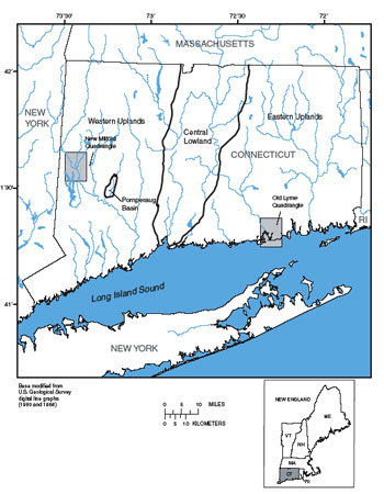
Generic ground-water-flow simulation models show that geohydrologic factors—fracture types, fracture geometry, and surficial materials—affect the size, shape, and location of source-water areas for bedrock wells. In this study, conducted by the U.S. Geological Survey in cooperation with the Connecticut Department of Public Health, ground-water flow was simulated to bedrock wells in three settings—on hilltops and hillsides with no surficial aquifer, in a narrow valley with a surficial aquifer, and in a broad valley with a surficial aquifer—to show how different combinations of geohydrologic factors in different topographic settings affect the dimensions and locations of source-water areas in Connecticut.
Three principal types of fractures are present in bedrock in Connecticut—(1) Layer-parallel fractures, which developed as partings along bedding in sedimentary rock and compositional layering or foliation in metamorphic rock (dips of these fractures can be gentle or steep); (2) unroofing joints, which developed as strain-release fractures parallel to the land surface as overlying rock was removed by erosion through geologic time; and (3) cross fractures and joints, which developed as a result of tectonically generated stresses that produced typically near-vertical or steeply dipping fractures.
Fracture geometry is defined primarily by the presence or absence of layering in the rock unit, and, if layered, by the angle of dip in the layering. Where layered rocks dip steeply, layer-parallel fracturing generally is dominant; unroofing joints also are typically well developed. Where layered rocks dip gently, layer-parallel fracturing also is dominant, and connections among these fractures are provided only by the cross fractures. In gently dipping rocks, unroofing joints generally do not form as a separate fracture set; instead, strain release from unroofing has occurred along gently dipping layer-parallel fractures, enhancing their aperture. In nonlayered and variably layered rocks, layer-parallel fracturing is absent or poorly developed; fracturing is dominated by well-developed subhorizontal unroofing joints and steeply dipping, tectonically generated fractures and (or) cooling joints. Cross fractures (or cooling joints) in nonlayered and variably layered rocks have more random orientations than in layered rocks. Overall, nonlayered or variably layered rocks do not have a strongly developed fracture direction.
Generic ground-water-flow simulation models showed that fracture geometry and other geohydrologic factors affect the dimensions and locations of source-water areas for bedrock wells. In general, source-water areas to wells reflect the direction of ground-water flow, which mimics the land-surface topography. Source-water areas to wells in a hilltop setting were not affected greatly by simulated fracture zones, except for an extensive vertical fracture zone. Source-water areas to wells in a hillside setting were not affected greatly by simulated fracture zones, except for the combination of a subhorizontal fracture zone and low bedrock vertical hydraulic conductivity, as might be the case where an extensive subhorizontal fracture zone is not connected or is poorly connected to the surface through vertical fractures.
Source-water areas to wells in a narrow valley setting reflect complex ground-water-flow paths. The typical flow path originates in the uplands and passes through either till or bedrock into the surficial aquifer, although only a small area of the surficial aquifer actually contributes water to the well. Source-water areas in uplands can include substantial areas on both sides of a river. Source-water areas for wells in this setting are affected mainly by the rate of ground-water recharge and by the degree of anisotropy. Source-water areas to wells in a broad valley setting (bedrock with a low angle of dip) are affected greatly by fracture properties. The effect of a given fracture is to channel the water downward from the surficial aquifer toward the open borehole. If leakage occurs through the vertical fractures, the source-water area is less affected by the fracture geometry. In one simulation, a fracture near the top of bedrock in a well allowed water to come from closer to the well, as in the case where there was not a good seal between the surficial aquifer and the borehole.
Ground-water-flow simulation models in Old Lyme, Connecticut, showed source-area results similar to results from the generic simulation models. Four simulation models at Old Lyme were used to test the effect of different assumptions about fracture-related properties: (A) a homogeneous medium, (B) discrete zones of high hydraulic conductivity that represent zones of closely spaced vertical fractures, (C) homogeneous rock with fracturing in one direction, and (D) a combination of (B) and (C). The four models fit the available data equally well. Source-water areas for the four different conceptual models were very similar to one another, except when the aquifer was simulated with a preferred orientation of hydraulic conductivity(conceptual model C). When a preferred orientation of hydraulic conductivity was assumed, modeled source-water areas were elongated in the direction of the principal hydraulic conductivity. Model C is reasonable because that model estimates a direction of higher hydraulic conductivity in the strike direction of layering, as expected, and the available hydrologic data support it. Model C also calculated the most difference in the estimated source-water areas; therefore, it is important to know if an aquifer has a preferred orientation of hydraulic conductivity.
VIEW a PDF file of
the complete report [27.8 MB] ![]()
U.S. Department of the Interior, U.S. Geological Survey
URL: https://pubsdata.usgs.gov/pubs/sir/2004/5132/index.html
For more information, contact J. Jeffrey Starn or Janet Radway Stone
Maintained by Eastern Publications Group
Last modified: 20:11:45 Thu 01 Dec 2016
Privacy statement | General disclaimer | Accessibility