![]()
Analysis and Mapping of Post-Fire Hydrologic Hazards for the 2002 Hayman, Coal Seam, and Missionary Ridge Wildfires, Colorado
By J.G. Elliott, M.E. Smith, M.J. Friedel, M.R. Stevens, C.R. Bossong, D.W. Litke, R.S. Parker, C. Costello, J. Wagner, S.J. Char, M.A. Bauer, and S.R. Wilds
USGS Scientific Investigations Report 2004-5300, 104 p., 22 figs.--ONLINE ONLY
This document also is available in pdf format:
![]() SIR2004-5300 (2.64MB)
SIR2004-5300 (2.64MB)
(Requires Adobe
Acrobat Reader)
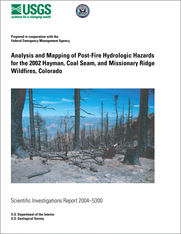
Cover photograph: View of the Animas River Valley from the Missionary Ridge burned area. Photograph by John G. Elliott, August 14, 2002.
The citation for this report, in USGS format, is as follows:
Elliott, J.G., Smith, M.E., Friedel, M.J., Stevens, M.R., Bossong, C.R.,
Litke, D.W., Parker, R.S., Costello, C., Wagner, J., Char, S.J., Bauer,
M.A., and Wilds, S.R., 2005, Analysis and mapping of post-fire hydrologic
hazards for the 2002 Hayman, Coal Seam, and Missionary Ridge wildfires,
Colorado: U.S. Geological Survey Scientific Investigations Report 2004-5300,
104 p.
Abstract
Wildfires caused extreme changes in the hydrologic, hydraulic, and geomorphologic characteristics of many Colorado drainage basins in the summer of 2002. Detailed assessments were made of the short-term effects of three wildfires on burned and adjacent unburned parts of drainage basins. These were the Hayman, Coal Seam, and Missionary Ridge wildfires. Longer term runoff characteristics that reflect post-fire drainage basin recovery expected to develop over a period of several years also were analyzed for two affected stream reaches: the South Platte River between Deckers and Trumbull, and Mitchell Creek in Glenwood Springs. The 10-, 50-, 100-, and 500-year flood-plain boundaries and water-surface profiles were computed in a detailed hydraulic study of the Deckers-to-Trumbull reach.
The Hayman wildfire burned approximately 138,000 acres (216 square miles) in granitic terrain near Denver, and the predominant potential hazard in this area is flooding by sediment-laden water along the large tributaries to and the main stem of the South Platte River. The Coal Seam wildfire burned approximately 12,200 acres (19.1 square miles) near Glenwood Springs, and the Missionary Ridge wildfire burned approximately 70,500 acres (110 square miles) near Durango, both in areas underlain by marine shales where the predominant potential hazard is debris-flow inundation of low-lying areas.
Hydrographs and peak discharges for pre-burn and post-burn scenarios were computed for each drainage basin and tributary subbasin by using rainfall-runoff models because streamflow data for most tributary subbasins were not available. An objective rainfall-runoff model calibration method based on nonlinear regression and referred to as the “objective calibration method” was developed and applied to rainfall-runoff models for three burned areas. The HEC-1 rainfall-runoff model was used to simulate the pre-burn rainfall-runoff processes in response to the 100-year storm, and HEC-HMS was used for runoff hydrograph generation.
Post-burn rainfall-runoff parameters were determined by adjusting the runoff-curve numbers on the basis of a weighting procedure derived from the U.S. Soil Conservation Service (now the National Resources Conservation Service) equation for precipitation excess and the effect of burn severity. This weighting procedure was determined to be more appropriate than simple area weighting because of the potentially marked effect of even small burned areas on the runoff hydrograph in individual drainage basins. Computed water-peak discharges from HEC-HMS models were increased volumetrically to account for increased sediment concentrations that are expected as a result of accelerated erosion after burning. Peak discharge estimates for potential floods in the South Platte River were increased by a factor that assumed a volumetric sediment concentration (Cv) of 20 percent. Flood hydrographs for the South Platte River and Mitchell Creek were routed down main-stem channels using watershed-routing algorithms included in the HEC-HMS rainfall-runoff model.
In areas subject to debris flows in the Coal Seam and Missionary Ridge burned areas, debris-flow discharges were simulated by 100-year rainfall events, and the inflow hydrographs at tributary mouths were simulated by using the objective calibration method. Sediment concentrations (Cv) used in debris-flow simulations were varied through the event, and were initial Cv 20 percent, mean Cv approximately 31 percent, maximum Cv 48 percent, Cv 43 percent at the time of the water hydrograph peak, and Cv 20 percent for the duration of the event. The FLO-2D flood- and debris-flow routing model was used to delineate the area of unconfined debris-flow inundation on selected alluvial fan and valley floor areas.
A method was developed to objectively determine the post-fire recovery period for the Hayman and Coal Seam burned areas using runoff-curve numbers (RCN) for all drainage basins for a 50-year period. A time assumed to be the recovery period was determined when the rate of change in the estimated 100-year flood peak became less than 5 percent per year. The method was based on a limited amount of historical data collected in drainage basins that were monitored during the post-fire recovery process.
The simulated post-burn 100-year peak discharges for 19 subbasins, routed to the point of confluence with the South Platte River, are expected to increase 3 to 90 times the pre-burn peaks in the short term. Among subbasins with greater than 50 percent moderately to severely burned areas, post-burn peak discharges are expected to be 28 to 91 times greater than pre-burn peaks. Post-fire recovery-time estimates are estimated to be 6 years for the Platte River upstream and downstream from Cheesman Reservoir.
Potential post-fire hazards in the Coal Seam burned area are waterflooding in Mitchell Creek and debris flows from smaller tributaries. Post-burn, sediment-bulked 100-year peak water flows for Mitchell Creek tributaries are expected to increase 2 to 21 times the pre-burn peaks. Post-burn peak discharges for points along the main stem of Mitchell Creek are expected to increase 3 to 4 times over the pre-burn peaks. Debris-flow analysis was done for 26 tributaries with drainage areas that ranged from 0.01 to 0.75 square mile. Estimates of the increase in 100-year discharge resulting from post-fire debris flows, relative to unburned conditions, range from 8 to 14 times in the Red Mountain area, 2 to 9 times in the West Glenwood Springs area, and 8 to 14 times for selected tributaries of Mitchell Creek. Post-fire recovery-time estimates were not made for the smaller subbasins burned by the Coal Seam wildfire; however, the estimated recovery time for Mitchell Creek is about 4 years.
Short-term effects of 100-year storm-generated debris flows in 25 tributaries in the Missionary Ridge burned area with drainage areas that range from 0.07 to 9.78 square miles were evaluated. The largest increase from estimated pre-burn discharge to post-burn debris flow 100-year discharge is expected to occur in Coon Creek where peak discharges could increase by a factor of greater than 240. Increases range from 9 to 38 times in other Animas River tributaries. In the Florida River area, increases range from 22 to 31 times, and in the Vallecito Reservoir and Los Pinos River areas, from 9 to 30 times.
Table of Contents
Abstract
Introduction
Purpose and Scope
Acknowledgments
Study Areas
Reconnaissance of 2002 Wildfires--Phase 1
Major 2002 Colorado Wildfires through July 2, 2002
High-Priority Wildfires Selected for Detailed Hydrologic Analyses
Hayman Wildfire Area
Coal Seam Wildfire Area
Missionary Ridge Wildfire Area
Dominant Post-Fire Hazard Processes
Methods for Post-Fire Flood Hazard Analysis--Phase 2
Short-Term Post-Fire Effects and Long-Term Recovery
Preparation of Digital Elevation Data
Rainfall-Runoff Model Calibration and Simulation
Pre-Burn Model Calibration
Post-Burn Adjustment of Model Parameters
Sediment Bulking of Estimated Discharge
Water-Flow Routing and Computation of Flood Elevations
Delineation of the 100-Year Flood Plain
Methods for Post-Fire Debris-Flow Hazard Analysis--Phase 2
Debris-Flow Mechanisms
Post-Fire Debris-Flow Peak Discharge Estimates
Debris-Flow Modeling in Colorado Wildfire Areas
Debris-Flow Routing with FLO-2D
Post-Fire Flood and Debris-Flow Hazard Maps
Method for Determination of Drainage Basin Recovery--Phase 3
Post-Fire Hydrologic Hazards for the Hayman Wildfire
South Platte River “Limited-Detail” Hydrologic Analysis--Phase 2
South Platte River Inflow Conditions
South Platte River Tributary Rainfall-Runoff Modeling
Rainfall-Runoff Model Methodology for the Hayman Wildfire
Step 1, Modeling of Unburned Conditions, South Platte River Tributaries
Step 2, Modeling of Burned Conditions, South Platte River Tributaries
Sediment Bulking of Discharge for Hayman Wildfire-Area Tributaries
Estimated Peak Discharges, South Platte River Tributaries
Estimated Peak Discharges, Selected Reaches of the South Platte River
South Platte River Hydrology and Peak Flow Analysis for Long-Term Recovery--Phase 3
South Platte River “Detailed” Hydraulic Analysis
Post-Fire Hydrologic Hazards for the Coal Seam Wildfire
Hydrologic Analysis of Mitchell Creek--Phase 2
Mitchell Creek Tributary Rainfall-Runoff Modeling
Step 1, Modeling of Unburned Conditions, Mitchell Creek Tributaries
Step 2, Modeling of Burned Conditions, Mitchell Creek Tributaries
Sediment Bulking and Peak Flood Discharge for Mitchell Creek
Mitchell Creek Hydrology and Peak Flow Modeling for Long-Term Recovery--Phase 3
Analysis of Debris-Flow-Producing Drainage Basins, Coal Seam Wildfire--Phase 2
Post-Fire Hydrologic Hazards for the Missionary Ridge Wildfire
Analysis of Debris-Flow-Producing Drainage Basins, Missionary Ridge Wildfire--Phase 2
Summary
Hayman Wildfire
Coal Seam Wildfire
Missionary Ridge Wildfire
References Cited
Appendix 1. Summary of Methods for Post-Fire and Debris-Flow Hazard Analyses
Appendix 2. The Manual Calibration Method for the Hayman Burned Area
Appendix 3. Appendix Tables 3-1--3-14
Appendix 4. Appendix Tables 4-1--4-2
Appendix 5. Appendix Tables 5-1--5-4
