
Prepared in cooperation with the Bureau of Land Management
Frequency, timing, and duration of streamflow were monitored in 20 ephemeral-stream channels across the Sierra Vista Subwatershed of the Upper San Pedro Basin, southeastern Arizona, during an 18-month period. One channel (Walnut Gulch) had Agricultural Research Service streamflow-gaging stations in place. The sediments of the remaining 19 ephemeral-stream channels were instrumented with multiple temperature loggers along the channel lengths. A thermograph-interpretation technique was developed in order to determine frequency, timing, and duration of streamflow in these channels. Streamflow onset was characterized by exceedance of a critical minimum drop in temperature within the channel sediments during any 15-minute interval, whereas streamflow cessation was identified by the local temperature minimum that immediately followed the critical temperature drop. All data for the 18-month period from December 1, 2000, to May 31, 2002, were analyzed in terms of monsoon (June 1 to September 19) and nonmonsoon (September 20 to May 31) periods. Nonmonsoon precipitation during the 2000–2002 study period (excludes October and November 2000) was 82 percent and 39 percent of the 30-year average, respectively, whereas monsoon precipitation during 2001 was 99 percent of the 30-year average. Ephemeral streamflow was detected at least once during the monitoring period at 87 percent of the monitoring sites (45 of the 52 sites that returned useful data; includes 4 streamflow-gaging stations). The summer monsoon period accounted for 82 percent of all streamflow events by number and 71 percent of all events by total streamflow duration. Nonmonsoon streamflow events peaked in number, total streamflow duration, and mean streamflow duration midway between the Huachuca Mountains and the San Pedro River on the west side of the subwatershed. These three streamflow parameters dropped off sharply about 10 kilometers from the mountain front. The number and total duration of nonmonsoon streamflows on the east side of the subwatershed trended downward with increased distance from the mountain fronts. Monsoon streamflow events were more evenly distributed across the subwatershed than nonmonsoon events, and the number and duration of streamflows generally trended upward with distance from the mountain fronts. Additional years of data are needed to determine whether these patterns are consistent year to year, or were due to randomness in the spatial distribution of precipitation. Streamflows in three ephemeral-stream channels were analyzed in detail. More than two-thirds of the streamflow events detected in each of these channels occurred at no more than one monitoring site along the channel length. In only one of the three channels—Garden Canyon—was a streamflow event detected at all logger sites along its length. Five temperature loggers provided data from urbanized areas, and these loggers detected streamflow more than 50 percent more often and of a duration nearly three times greater than did temperature loggers across the rural parts of the subwatershed. Because historical records do not indicate that more precipitation occurs in the urbanized area than in the rural areas, the increased frequency of flow detection in the urban area is attributed to an increase in runoff from the impervious surfaces throughout the urbanized area.
Abstract
Introduction
Acknowledgments
Purpose and Scope
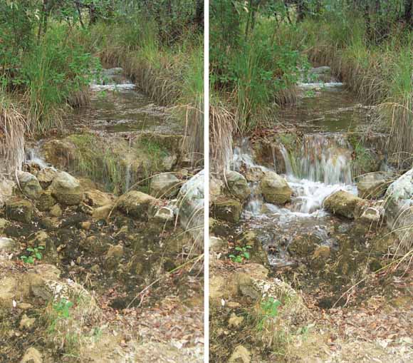
Description of the Study Area
Vegetation and Climate
Methods of Investigation
Theory
Application of Theory
Installation of Temperature Loggers
Monitoring Sites
Precipitation Patterns During the Monitoring Period
Timing and Duration of Flow in Ephemeral Streams
Spatial Streamflow Patterns
Temporal Streamflow Patterns
Frequency of Streamflow in Three Representative Channels
Garden Canyon Wash
Ramsey Canyon Wash
Greenbush Draw
Variability of Streamflow in Three Representative Channels
Summary and Conclusions
References Cited
Appendix
This report is available online in Portable Document Format (PDF). If you do not have the Adobe Reader, it is available for free download from Adobe Systems Incorporated.
Document Accessibility: Adobe Systems Incorporated has information about PDFs and the visually impaired. This information provides tools to help make PDF files accessible. These tools convert Adobe PDF documents into HTML or ASCII text, which then can be read by a number of common screen-reading programs that synthesize text as audible speech. In addition, an accessible version of Adobe Reader 7.0 for Windows (English only), which contains support for screen readers, is available. These tools and the accessible reader may be obtained free from Adobe at Adobe Access
For more information about USGS activities in Arizona, visit the USGS Arizona Water Science Center home page
Send questions or comments about this report to Bruce Gungle, (520) 670-6671.

![]() U.S. Department of the Interior | U.S. Geological Survey
U.S. Department of the Interior | U.S. Geological Survey
Persistent URL: https://pubs.usgs.gov/sir/2005/5190/
Page Contact Information: Michael Diggles
Page Last Modified: March 6, 2007 (mfd)