Arizona Water Science Center
Prepared in cooperation with the Arizona Department of Water Resources
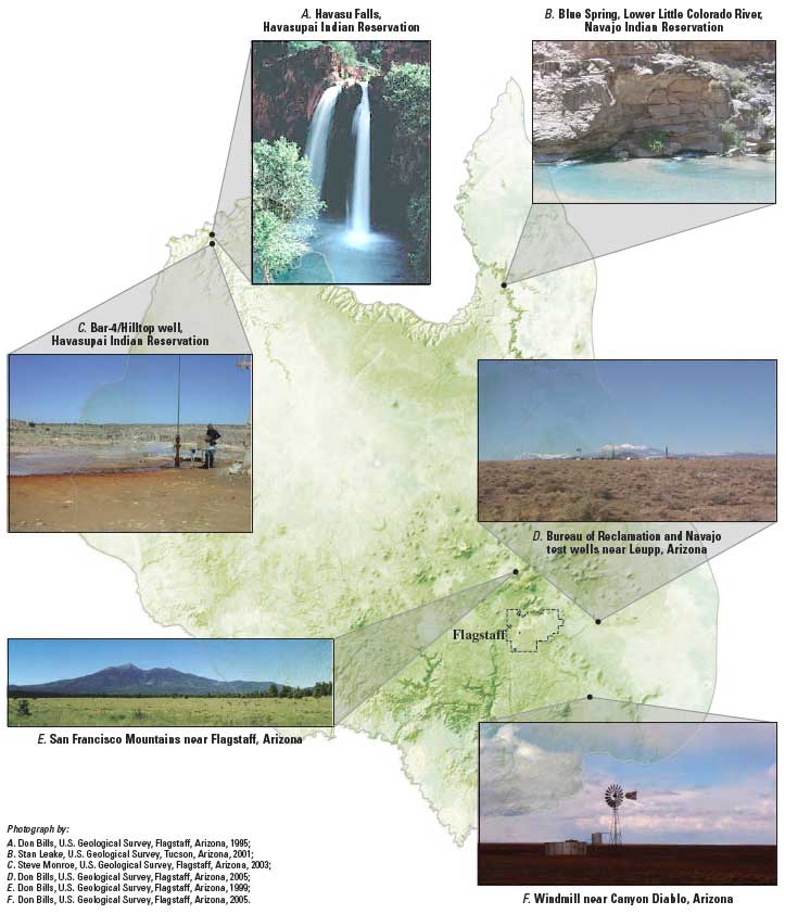 Two large, regional ground-water flow systems occur in the Coconino Plateau and adjacent areas: the C aquifer and the Redwall-Muav aquifer. The C aquifer occurs mainly in the eastern and southern parts of the 10,300-square-mile Coconino Plateau study area, and the Redwall-Muav aquifer underlies the entire study area. The C aquifer is a water-table aquifer for most of its occurrence with depths to water that range from a few hundred feet to more than 1,500 feet. In the western part of the Coconino Plateau study area, the C aquifer is dry except for small localized perched water-bearing zones decoupled from the C aquifer to the east. The Redwall-Muav aquifer underlies the C aquifer and ranges from at least 3,000 feet below land surface in the western part of the Coconino Plateau study area to more than 3,200 feet below land surface in the eastern part of the study area. The Redwall-Muav aquifer is a confined aquifer for most of its occurrence with hydraulic heads of several hundred to more than 500 feet above the top of the aquifer in the western part of the study area and more than 2,000 feet above the top of the aquifer in the eastern part of the study area near Flagstaff. In the eastern and northeast parts of the area, the C aquifer and the Redwall-Muav aquifer are in partial hydraulic connection through faults and other fractures.
Abstract
Introduction
Purpose and Scope
Acknowledgments
Methods of Investigation
Hydrogeologic Framework
Water Chemistry
Field and Laboratory Methods
Isotope Constituent Analyses of Water, Rock Samples, and Well Cuttings
X-ray Diffraction Analyses of Rock Samples and Well Cuttings
Isotopic Geochemical Approach
Statistical Analyses
Conceptual Model and Water Budget
Description of Study Area
Physiography
Climate
Vegetation and Land Use
Population and Water-Resource Development
Previous Investigations
Hydrogeology
Precipitation Patterns
Geology
Stratigraphy
Tectonic History and Geologic Structure
Surface Water
Ground Water
Perched Ground Water
C Aquifer
Water Level and Saturated Thickness
Recharge and Discharge
Aquifer Properties and Well Yield
Redwall-Muav Aquifer
Water Levels and Saturated Thickness
Recharge and Discharge
Aquifer Properties and Well Yield
Ground-Water Development and Water Use
Water Chemistry
Quality of Water
Isotope Hydrology
Conceptual Model of the Ground-Water Flow Systems
Regional and Local Flow-System Boundaries
Source, Occurrence, and Movement of Ground Water in the Flow Systems
Horizontal and Vertical Flow Paths
Effluent Recharge
Relation of Hydrologic Flow Components
Water Budgets
Considerations for Additional Data Collection and Monitoring
Summary and Conclusions
References Cited
Supplemental Data
1. Map showing surface geology, geologic structure, and sections of the Coconino Plateau and adjacent areas, Coconino and Yavapai Counties, Arizona
2. Map showing perennial and ephemeral reaches of principal streams, active and discontinued U.S. Geological Survey streamflow-gaging stations, ground-water levels, Coconino Plateau and adjacent areas, Coconino and Yavapai Counties, Arizona
3. Maps showing location of selected wells, springs, and the potentiometric surface of the C aquifer and Redwall-Muav aquifer, Coconino Plateau and adjacent areas, Coconino and Yavapai Counties, Arizona
4. Map showing water chemistry, tritium, and carbon-age data for selected wells and springs that issue from the C aquifer and Redwall-Muav aquifer and for selected surface-water sites, Coconino Plateau and adjacent areas, Coconino and Yavapai Counties, Arizona
1. Location and geographic features of the Coconino Plateau study area, Coconino and Yavapai Counties, Arizona
2. U.S. Geological Survey Rural Watershed Initiative study areas in north-central Arizona
3. Mean and annual precipitation and average annual evaporation, Coconino Plateau study area, Coconino and Yavapai Counties, Arizona
4. Vegetation types in the Coconino Plateau study area, Coconino and Yavapai Counties, Arizona
5. Land ownership in the Coconino Plateau study area, Coconino and Yavapai Counties, Arizona
6. Annual and average precipitation for selected weather stations, Coconino Plateau study area, Coconino and Yavapai Counties, Arizona
7. Average annual precipitation for all reporting weather stations, Coconino Plateau study area, Coconino and Yavapai Counties, Arizona
8. Generalized stratigraphic section of rock units in the Coconino Plateau study area, Coconino and Yavapai Counties, Arizona
9. Annual winter base flow for selected streamflow-gaging stations, Coconino Platea study area, Coconino and Yavapai Counties, Arizona
10. Annual and total ground-water withdrawals from the C aquifer and the Redwall-Muav aquifer in the Coconino Plateau study area, Arizona, 1975–2003
11. Relative ion composition of water from springs, streams, and wells that are points for discharge from the C aquifer and the Redwall-Muav aquifer, Coconino Plateau study area, Coconino and Yavapai Counties, Arizona, 1975–2003
12. Concentrations of sulfate in relation to spring or stream locations near the south rim of Grand Canyon from the mouth of the Little Colorado River to Mohawk Canyon, Arizona, 1991–2002
13. Relation between concentrations of dissolved solids and major ions in water from springs, streams, and wells in the Coconino Plateau study area, Coconino and Yavapai Counties, Arizona, 1921–2003
14. Grouping of sites based on principal components analysis and hierarchical cluster analysis (HCA) of major-ion data for water from selected springs, streams, and wells, Coconino Plateau study area, Coconino and Yavapai Counties, Arizona, 1991–2003
15. Oxygen and hydrogen data for precipitation and for springs, streams, and wells that are discharge points from the C aquifer and the Redwall-Muav aquifer, Coconino Plateau study area, Coconino and Yavapai Counties, Arizona
16. Strontium isotope values for water, Coconino Plateau study area, Coconino and Yavapai Counties, Arizona 2000–2003
17. Relation between tritium and carbon-14 in water from springs, streams, and wells that are discharge points for the C aquifer and the Redwall-Muav aquifer, Coconino Plateau study area, Coconino and Yavapai Counties, Arizona, 1991–2003
18. Schematic representation of water-budget components for the Coconino Plateau study area, Coconino and Yavapai Counties, Arizona
1. Sources of water-chemistry data for sample sites, Coconino Plateau study area, Coconino and Yavapai Counties, Arizona
2. Drainage-basin characteristics of principal streams, Coconino Plateau study area, Coconino and Yavapai Counties, Arizona
3. Base-flow discharge estimates from springs and streams, Coconino Plateau study area, Coconino and Yavapai Counties, Arizona
4. Aquifer properties of the C aquifer and the Redwall-Muav aquifer, Coconino Plateau study area, Coconino and Yavapai Counties, Arizona
5. Estimated annual ground-water withdrawals from the C aquifer and Redwall-Muav aquifer, Coconino Plateau study area, Coconino and Yavapai Counties, Arizona, 1975–2003
6. Results of principal components analysis of major-ion data for water from selected springs, streams, and wells, Coconino Plateau study area, Coconino and Yavapai Counties, Arizona, 1991–2003
7. Summary of hydrogen and oxygen isotope data, from precipitation and from water discharging from the C aquifer and the Redwall-Muav aquifer, Coconino Plateau study area, Coconino and Yavapai Counties, Arizona, 1962−2004
8. Strontium and carbon-13 isotope data and X-ray diffraction mineralogy for selected water and rock samples representing the major stratigraphic units on the Coconino Plateau study area, Coconino and Yavapai Counties, Arizona
9. Estimated steady-state water budget (pre-1975) for Coconino Plateau flow systems, Coconino Plateau study area, Coconino and Yavapai Counties, Arizona
10. Estimated transient-state water budget (2002) for Coconino Plateau flow systems, Coconino Plateau study area, Coconino and Yavapai Counties, Arizona
Bills, D.J., Flynn, M.E., and Monroe, S.A., 2007, Hydrogeology of the Coconino Plateau and adjacent areas, Coconino and Yavapai Counties, Arizona: U.S. Geological Survey Scientific Investigations Report 20055222, version 1.1, 101 p., 4 plates, https://dx.doi.org/10.3133/sir20055222v1.1.
This report is available online in Portable Document Format (PDF). If you do not have the Adobe Acrobat PDF Reader, it is available for free download from Adobe Systems Incorporated.
Download the text of this report as a 115-page PDF document (sir2005-5222_text.pdf; 7.9 MB)
Download Plate 1 of this report as a ~30" x 32" PDF document (sir2005-5222_plate1.pdf; 8.9 MB)
Download Plate 2 of this report as a ~30" x 32" PDF document (sir2005-5222_plate2.pdf; 17.8 MB)
Download Plate 3 of this report as a ~31" x 25" PDF document (sir2005-5222_plate3.pdf; 17.4 MB)
Download Plate 4 of this report as a ~24" x 32" PDF document (sir2005-5222_plate4.pdf; 17.4 MB)
Send questions or comments about this report to the author, Donald J. Bills , (928) 556-7142.
For more information about water activities in Arizona, visit the ARIZONA DEPARTMENT OF WATER RESOURCES
Document Accessibility: Adobe Systems Incorporated has information about PDFs and the visually impaired. This information provides tools to help make PDF files accessible. These tools convert Adobe PDF documents into HTML or ASCII text, which then can be read by a number of common screen-reading programs that synthesize text as audible speech. In addition, an accessible version of Acrobat Reader 8.0 for Windows (English only), which contains support for screen readers, is available. These tools and the accessible reader may be obtained free from Adobe at Adobe Access home page.

![]() U.S. Department of the Interior | U.S. Geological Survey
U.S. Department of the Interior | U.S. Geological Survey
URL: https://pubs.usgs.gov/sir/2005/5222/
Page Contact Information: Michael Diggles
Page Last Modified: October 19, 2007