Scientific Investigations Report 2006–5043
U.S. GEOLOGICAL SURVEY
Scientific Investigations Report 2006–5043
The Colorado River water recharges ground water in the adjacent flood-plain aquifer. The ground water is used by phreatophytes growing on the flood plain.
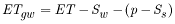
The Bowen-ratio and LCRAS (reference ET and ET coefficient) methods, as described in this report account for total ET. The source of water lost to total ET includes surface water (excluding the LCR) introduced into the study area as a result of flooding, local precipitation, and ground-water loss (LCR water). Any surface water and local precipitation amounts can be adjusted to determine ground-water ET by using:
 , (12)
where

|
is ground water use or discharge (length), |

|
is surface-water inflow from lower Colorado River tributaries (length), |

|
is annual precipitation occurring on the flood plain (length), and |

|
is soil water storage (length). |
For purposes of this report, ![]() is assumed to be negligible. Surface water, as a result of storms, rarely enters the LCR flood plain from tributaries. When storm events produce runoff, the flow usually is restricted to channels that discharge directly into the LCR and the tributary surface water commingles with LCR water. Any subsequent ET loss of ground water recharged from commingled LCR water is considered entirely to be loss of LCR water.
is assumed to be negligible. Surface water, as a result of storms, rarely enters the LCR flood plain from tributaries. When storm events produce runoff, the flow usually is restricted to channels that discharge directly into the LCR and the tributary surface water commingles with LCR water. Any subsequent ET loss of ground water recharged from commingled LCR water is considered entirely to be loss of LCR water.
Some precipitation falling on the flood plain may infiltrate and accumulate in the soil. Water stored in the soil is available for ET at a later time. Thus, if there is an increase in soil-water storage due to recent precipitation, precipitation needs to be reduced by that amount to avoid overcorrection of ET due to precipitation. If there is a decrease in soil-water storage due to ET, precipitation (even if it equals zero) needs to be increased by that amount to avoid overestimating ![]() . However, because of the paucity of precipitation (2005 was an extremely wet year and only 0.76 ft of rain was recorded at Mohave AZMET station) and normally infrequent rain events only a small fraction of precipitation on the LCR flood plain is stored as soil water. Because the amount of stored soil water is very small compared to ET rates, this component was disregarded for this study.
. However, because of the paucity of precipitation (2005 was an extremely wet year and only 0.76 ft of rain was recorded at Mohave AZMET station) and normally infrequent rain events only a small fraction of precipitation on the LCR flood plain is stored as soil water. Because the amount of stored soil water is very small compared to ET rates, this component was disregarded for this study.
Total ground-water discharge was estimated by (1) subtracting annual precipitation from annual Bowen-ratio ET rates to determine ![]() , (2) determining the acreage of phreatophytes, and (3) multiplying acreage by
, (2) determining the acreage of phreatophytes, and (3) multiplying acreage by ![]() . Estimates of total ground-water discharge are presented for the phreatophytes growing within the HNWR.
. Estimates of total ground-water discharge are presented for the phreatophytes growing within the HNWR.
Most of the precipitation that reaches the ground along the LCR evaporates from soil and plant surfaces or infiltrates the soil, temporarily increasing soil moisture. The flat ground surface and lack of channels indicate that runoff due to direct precipitation is negligible. Also, due to the normally small amounts of precipitation, it is unlikely that a significant amount of precipitation recharges the ground water. Therefore, almost all precipitation is lost to evaporation or ET. The overall short-term effect of precipitation on ET is to reduce the use of ground water by the amount of precipitation. In some instances, precipitation may invigorate plant growth, which may have an effect of increasing ground-water ET.
Adjusting ET for precipitation for periods of 1 month currently is impractical, because the amount of time it takes for the water to return to the atmosphere is highly variable. The amount of time depends on the magnitude of seasonal precipitation, air temperature, ambient soil moisture, depth that the water infiltrates, and vegetation density. A more detailed study would be required to quantify all the variables and relate them to ET.
Monthly precipitation does not exceed monthly ET during the warm months when ET is high, but monthly precipitation does exceed monthly ET during some cool months when ET is low and precipitation is high (fig. 20). Adjusting monthly ET on a monthly basis may result in months of negative ET (fig. 21). However, LCR water use (![]() ) by phreatophytes could be near zero during the few months when precipitation is abundant. Monthly ET is the sum of daily ET computed using the modified daily
) by phreatophytes could be near zero during the few months when precipitation is abundant. Monthly ET is the sum of daily ET computed using the modified daily ![]() and daily reference ET.
and daily reference ET.
Annual phreatophytic ET can be adjusted for annual precipitation; because during a 1-year period, most of the precipitation likely will evaporate or transpire. Annual ET estimated using the modified ![]() method was adjusted by subtracting total annual precipitation from the total annual ET for each Bowen-ratio station and barren soil (table 7). Precipitation is reported by Bureau of Reclamation (2004).
method was adjusted by subtracting total annual precipitation from the total annual ET for each Bowen-ratio station and barren soil (table 7). Precipitation is reported by Bureau of Reclamation (2004).
HNWR was subdivided into areas of vegetation with similar relative density using remote sensing techniques described by Laczniak and others (1999), Reiner and others (2002), and DeMeo and others (2003). Vegetation groups and associated ET units were delineated using a June 2004 thematic mapper image and applying a vegetation-classification method based on calculated reflectance values for each pixel in the image. The magnitude and change of reflectance values depend, in part, on the amount of chlorophyll absorption that occurs within the plant giving an indication of the plant vigor and vegetation density. ET units were delineated by grouping image pixels with a similar spectral response, and then determining the density of vegetation in each ET unit by field observations. The area within the phreatophyte boundary was subdivided into four ET units, which correspond to relative densities of the three ET stations and barren ground. Because this method results in transitional boundaries, LCRAS Geographic Information System phreatophyte data for 2000 were used to provide a consistent phreatophytic-area boundary within the HNWR. The area of each ET unit was computed and multiplied by the associated annual ET to compute total LCR water use by phreatophytes within the LCRAS boundary from Davis Dam to Parker Dam (table 8).
The BOR reported 57,610 and 55,221 acre-ft of phreatophytic LCR water use (including marsh vegetation) in 2002 and 2003, respectively, for HNWR (U.S. Bureau of Reclamation, 2004). After adjusting for marsh ET, which was reported as 16,662 acre-ft and 15,895 acre-ft in 2002 and 2003, respectively, the 2002 and 2003 average annual use of LCR water by nonaquatic phreatophytes at HNWR was 40,137 acre-ft. A total of 25,749 acre-ft of phreatophytic water use was estimated for 2004 for HNWR using the modified coefficient method (table 8), which is about two-thirds of the average nonaquatic phreatophytic water use of 40,137 acre-ft computed for LCRAS for 2002 and 2003 (U.S. Bureau of Reclamation, 2004). The relatively high estimate of reported ET is due mostly to substantially higher LCRAS estimates of phreatophyte ET rates and to a lesser degree because LCRAS ET estimates were not adjusted for precipitation.
Although the modified coefficients were derived empirically for the Topock Marsh area, the method can be used for other areas along the LCR. The modified coefficients are derived from average daily computed coefficients and represent average growth development of phreatophytes. The daily computed coefficients represent an average relation between Bowen-ratio ET of phreatophytes and daily ![]() . The dormancy period of plants will be slightly shorter for areas farther south of Topock Marsh, but the general growth development should be similar. The minimum modified
. The dormancy period of plants will be slightly shorter for areas farther south of Topock Marsh, but the general growth development should be similar. The minimum modified ![]() will be about the same value, but may apply for a shorter period, whereas the maximum modified
will be about the same value, but may apply for a shorter period, whereas the maximum modified ![]() will be about the same value also, but apply for a longer period. The modified
will be about the same value also, but apply for a longer period. The modified ![]() curve for dense vegetation would be affected some, whereas the modified
curve for dense vegetation would be affected some, whereas the modified ![]() curves for medium and low-density vegetation would change only slightly, and the modified
curves for medium and low-density vegetation would change only slightly, and the modified ![]() curve for barren soil is expected to be the same.
curve for barren soil is expected to be the same.
For more information about USGS activities in Nevada, visit the USGS Nevada Water Science Center home page .

![]() U.S. Department of the Interior |
U.S. Geological Survey
U.S. Department of the Interior |
U.S. Geological Survey
Persistent URL: https://pubs.water.usgs.gov/sir20065043
Page Contact Information: Publications Team
Page Last Modified: Thursday, 01-Dec-2016 18:55:56 EST
