Geographic Analysis and Monitoring Program
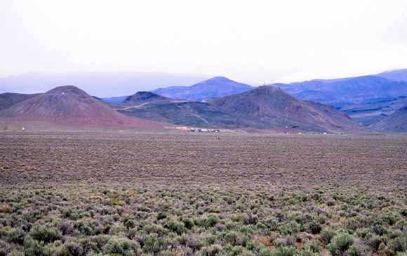
Field photo of sagebrush plant community. Sagebrush makes up more than one third of the vegetation in the Central Basin and Range ecoregion.
The U.S. Geological Survey (USGS) Land Cover Trends research project is focused on understanding the amounts, rates, trends, causes, and implications of contemporary land-use and land-cover (LU/LC) change in the United States. This project is supported by the USGS Geographic Analysis and Monitoring Program in collaboration with the U.S. Environmental Protection Agency (EPA) and the National Aeronautics and Space Administration (NASA).
LU/LC change is a pervasive process that modifies landscape characteristics and affects a broad range of socioeconomic, biologic, and hydrologic systems. Understanding the impacts and feedbacks of LU/LC change on environmental systems requires an understanding of the rates, patterns, and driving forces of past, present, and future LU/LC change. The objectives of the Land Cover Trends project are to (1) determine and describe the amount, rates, and trends of contemporary LU/LC change by ecoregion for the period 1973-2000 for the conterminous United States, (2) document the causes, driving forces, and implications of change, and (3) synthesize individual ecoregion results into a national assessment of LU/LC change.
The Land Cover Trends research team includes staff from the USGS National Center for Earth Resources Observation and Science (EROS), Rocky Mountain Geographic Science Center, Eastern Geographic Science Center, Mid-Continent Geographic Science Center, and the Western Geographic Science Center. Other partners include researchers at South Dakota State University, University of Southern Mississippi, and State University of New York College of Environmental Science and Forestry.
This report presents an assessment of LU/LC change in the Central Basin and Range ecoregion for the period 1973-2000. The Central Basin and Range ecoregion is one of 84 Level-III ecoregions as defined by the Environmental Protection Agency. Ecoregions have served as a spatial framework for environmental resource management and to denote areas that contain a geographically distinct assemblage of biotic and abiotic phenomena including geology, physiography, vegetation, climate, soils, land use, wildlife, and hydrology. The established Land Cover Trends methodology generates estimates of LU/LC change using a probability sampling approach and change-detection analysis of thematic land-cover images derived from Landsat satellite imagery.
Download this report as a 24-page PDF file (sir2006-5288.pdf; 8.5 MB)
For questions about the content of this report, contact Christopher Soulard
Download a copy of the latest version of Adobe Reader for free.
|
Help |
PDF help |
Publications main page |
| Western Scientific Investigations Reports |
| Geography | Geographic Analysis and Monitoring Program
|

![]() U.S. Department of the Interior | U.S. Geological Survey
U.S. Department of the Interior | U.S. Geological Survey
URL: https://pubs.usgs.gov/sir/2006/5288/
Page Contact Information: Michael Diggles
Page Created: November 20, 2006
Page Last Modified: November 18, 2009