Scientific Investigations Report 2007-5034
Report PDF (1 MB)
|
AbstractA numerical water-balance model was developed to simulate the responses of a wetland on the Fort Berthold Reservation, North Dakota, to historical and possible extreme hydrological inputs and to changes in hydrological inputs that might occur if a proposed refinery is built on the reservation. Results from model simulations indicated that the study wetland would likely contain water during most historical and extreme-precipitation events with the addition of maximum potential discharges of 0.6 acre-foot per day from proposed refinery holding ponds. Extended periods with little precipitation and above-normal temperatures may result in the wetland becoming nearly dry, especially if potential holding-pond discharges are near zero. Daily simulations based on the historical-enhanced climate data set for May and June 2005, which included holding-pond discharges of 0.6 acre-foot per day, indicated that the study-wetland maximum simulated water volume was about 16.2 acre-feet and the maximum simulated water level was about 1.2 feet at the outlet culvert. Daily simulations based on the extreme summer data set, created to represent an extreme event with excessive June precipitation and holding-pond discharges of 0.6 acre-foot per day, indicated that the study-wetland maximum simulated water volume was about 38.6 acre-feet and the maximum simulated water level was about 2.6 feet at the outlet culvert. A simulation performed using the extreme winter climate data set and an outlet culvert blocked with snow and ice resulted in the greatest simulated wetland water volume of about 132 acre-feet and the greatest simulated water level, which would have been about 6.2 feet at the outlet culvert, but water was not likely to overflow an adjacent highway. |
Vining, K.C., 2007, Water-balance model of a wetland on the Fort Berthold Reservation, North Dakota: U.S. Geological Survey Scientific Investigations Report 2007–5034, 15 p.
Abstract
Introduction
Purpose and Scope
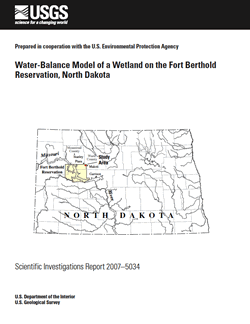
Description of Study Area
Study-Area Surveys
Wetland Water-Balance Model
Model Simulation Results
Model Limitations
Summary
References Cited
| For additional information contact: Director, North Dakota Water Science Center U.S. Geological Survey 821 East Interstate Avenue Bismarck, ND 58503-1199 World Wide Web: http://nd.water.usgs.gov/ |
Document Accessibility: Adobe Systems Incorporated has information about PDFs and the visually impaired. This information provides tools to help make PDF files accessible. These tools convert Adobe PDF documents into HTML or ASCII text, which then can be read by a number of common screen-reading programs that synthesize text as audible speech. In addition, an accessible version of Acrobat Reader 7.0 for Windows (English only), which contains support for screen readers, is available. These tools and the accessible reader may be obtained free from Adobe at Adobe Access. |

![]() U.S. Department of the Interior | U.S. Geological Survey
U.S. Department of the Interior | U.S. Geological Survey
URL: http://pubsdata.usgs.gov/pubs/sir/2007/5034/index.html
Questions or Assistance: Contact USGS
Last modified: Thursday, 01-Dec-2016 19:41:07 EST