Pacific Islands Water Science Center
This report is available as a pdf.
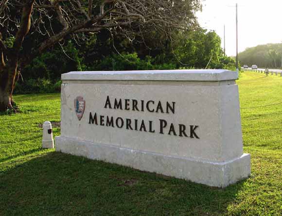
American Memorial Park, a unit of the National Park Service on the Island of Saipan, includes among its features a 27-acre estuarine system that has become a rarity within the Commonwealth of the Northern Mariana Islands. The estuarine system's mosaic of marshy areas interspersed with emergent wetlands and mixed wet forests provides critical habitat for various migratory and resident waterfowl, including two Federally listed endangered species: the Marianas gallinule (Gallinula chloropus guami) and the nightingale reed warbler (Acrocephalus luscinia). With sensitivity to the park's ecologic assets and the uncertainty associated with locally rapid urbanization, a need to better understand the hydrology of American Memorial Park was recognized. To address that need, a reconnaissance study of the park was undertaken during August and September 2005. The goals of the study were (1) to describe the occurrence and salinity of surface and ground water within the park; (2) to develop a hydrologic model of the park area of the island, with emphasis on the 27-acre estuarine system; and (3) to identify additional data needed to further develop this model.
With regard to surface water, three freshwater inputs to the park's natural wetland are possible: direct rainfall, seaward-flowing ground water, and overland flow. Direct rainfall, which is an important source of freshwater to the wetland, commonly exceeds evapotranspiration both seasonally and per storm. The seaward flow of ground water is likely to be a source of freshwater to the wetland because ground water generally has an upward vertical component in the nearshore environment. Overland flow upgradient of the park could potentially contribute a significant input of freshwater during periods of intense rainfall, but roads that flank the park's perimeter act as a barrier to surficial inflows.
During the reconnaissance, four discrete bodies, or zones, of surface water were observed within the park's natural wetland. Conductivity within these surface-water zones typically ranged from 1,540 to 4,370 microsiemens per centimeter (µS/cm) at 25°C, although values as low as 829 and as high as 8,750 µS/cm were measured. As a result of these observations, the American Memorial Park wetland area meets the definition criteria of an estuarine system that is dominantly oligohaline. Conductivity was also measured in a constructed wetland that was built within the park to augment the storm-drainage infrastructure of the village of Garapan. Reverse-osmosis facilities, in operation at hotels adjacent to the park, have historically discharged highly saline wastewater into the storm-drainage system. This collective storm and wastewater flow is routed into the constructed wetland and from there into the ocean. The conductivity of water in the constructed wetland ranged from 45,000 to 62,500 µS/cm, exceeding nominal seawater values by as much as 25 percent, with the highest conductivities recorded near discharging storm drains.
With regard to ground water, the reconnaissance included installation of a ground-water-monitoring network. Data collected from this network identified the presence of freshwater underlying the park and indicated that surface water is directly connected to ground water in the natural wetland because the water levels of both surface water and ground water directly varied with the tide. Conductivities of ground-water samples from wells in the monitoring network indicated that ground-water salinity was geographically related: conductivities were lower (801-2,490 µS/cm) in surficially dry areas, intermediate (6,090-9,180 µS/cm) in natural-wetland areas, and higher (18,250-27,700 µS/cm) in areas adjacent to the constructed wetland and its associated ocean-discharge channel.
Synoptic water-level surveys were made to enhance understanding of the spatial expression of the water table; they were scheduled to overlap with peak and trough tidal signals to enable limited characterization of local hydrologic properties. The water-level surveys indicated that ground-water levels were directly influenced by ocean tides because tidal fluctuations were reflected in ground-water levels. The surveys also indicated that at any given time ground-water levels were higher than ocean-water levels and that this water-level offset was greater at low than at high tide and greater in the western than in the eastern part of the park. Tidal lags were calculated for the entire park, and tidal efficiencies were calculated for the natural-wetland area. These data suggest that hydraulic conductivity in subsurface strata may be higher in the eastern than in the western part of the park; mean lag time in the eastern part of the park was 21 minutes, in contrast with 115 minutes in the western part. Tidal efficiencies in the eastern part of the park ranged from 0.38 to 0.85, with a mean of 0.64.
With regard to continuing information gaps, additional monitoring wells would need to be installed to constrain ground-water flow through the park, including the vertical flow component, and to improve understanding of the effects of nearby faults and injection wells on local hydrology. Understanding of the effects of the perimeter-flanking roads on freshwater flow, both surface and subsurface, could be enhanced by expanding the ground-water-monitoring network and by monitoring surface flows that are being artificially diverted around the park to the ocean. A long-term plan that includes monitoring of surface and subsurface water levels and salinities could be useful to identify trends that could affect the park's critical habitat, including its endemic and endangered species. Development of a numerical model, addressing coupled surface-water/ground-water flow and solute transport, could assist in assessing hydrologic changes and serve as a communication tool to inform interested parties of such changes to the park's hydrologic characteristics, including those changes that may affect critical habitats.
Download this report as an 42-page PDF file (sir2007-5042.pdf; 3.8 MB)
For questions about the content of this report, contact Jeff Perreault
Suggested citation and version history
Download a current version of Adobe Reader for free
| Help
| PDF help
| Publications main page | Western Scientific Investigations Reports |
| Water Resources | Pacific Islands Water Science Center
|
This report is also available in print from:
USGS Information Services, Box 25286,
Federal Center, Denver, CO 80225
telephone: 888 ASK-USGS; e-mail: infoservices@usgs.gov

![]() U.S. Department of the Interior | U.S. Geological Survey
U.S. Department of the Interior | U.S. Geological Survey
URL: https://pubs.usgs.gov/sir/2007/5042/
Page Contact Information: Michael Diggles
Page Last Modified: May 1, 2008