Scientific Investigations Report 2007-5098
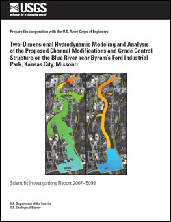
AbstractThe Blue River Channel Modification project being implemented by the U.S. Army Corps of Engineers (USACE) is intended to provide flood protection within the Blue River valley in the Kansas City, Mo., metropolitan area. In the latest phase of the project, concerns have arisen about preserving the Civil War historic area of Byram's Ford and the associated Big Blue Battlefield while providing flood protection for the Byram's Ford Industrial Park. In 1996, the USACE used a physical model built at the Waterways Experiment Station (WES) in Vicksburg, Miss., to examine the feasibility of a proposed grade control structure (GCS) that would be placed downstream from the historic river crossing of Byram's Ford to provide a subtle transition of flow from the natural channel to the modified channel. The U.S. Geological Survey (USGS), in cooperation with the USACE, modified an existing two-dimensional finite element surface-water model of the river between 63d Street and Blue Parkway (the "original model"), used the modified model to simulate the existing (as of 2006) unimproved channel and the proposed channel modifications and GCS, and analyzed the results from the simulations and those from the WES physical model. Modifications were made to the original model to create a model that represents existing (2006) conditions between the north end of Swope Park immediately upstream from 63d Street and the upstream limit of channel improvement on the Blue River (the "model of existing conditions"). The model of existing conditions was calibrated to two measured floods. The model of existing conditions also was modified to create a model that represents conditions along the same reach of the Blue River with proposed channel modifications and the proposed GCS (the "model of proposed conditions"). The models of existing conditions and proposed conditions were used to simulate the 30-, 50-, and 100-year recurrence floods. The discharge from the calibration flood of May 15, 1990, also was simulated in the models of existing and proposed conditions to provide results for that flood with the current downstream channel modifications and with the proposed channel modifications and GCS. Results from the model of existing conditions show that the downstream channel modifications as they exist (2006) may already be affecting flows in the unmodified upstream channel. The 30-year flood does not inundate most of the Byram's Ford Industrial Park near the upstream end of the study area. Analysis of the 1990 flood (with the historical 1990 channel conditions) and the 1990 flood simulated with the existing (2006) conditions indicates a substantial increase in velocity throughout the study area and a substantial decrease in inundated area from 1990 to 2006. Results from the model of proposed conditions show that the proposed channel modifications will contain the 30-year flood and that the spoil berm designed to provide additional flood protection for the Byram's Ford Industrial Park for the 30-year flood prevents inundation of the industrial park. In the vicinity of Byram's Ford for the 30-year flood, the maximum depth increased from 39.7 feet (ft) in the model of existing conditions to 43.5 ft in the model of proposed conditions, with a resulting decrease in velocity from 6.61 to 4.55 feet per second (ft/s). For the 50-year flood, the maximum depth increased from 42.3 to 45.8 ft, with a decrease in velocity from 6.12 to 4.16 ft/s from existing to proposed conditions. For the 100-year flood, the maximum depth increased from 44.0 to 46.6 ft, with a decrease in velocity from 5.64 to 4.12 ft/s from existing to proposed conditions. When the May 15, 1990, discharge is simulated in the model of existing conditions (with the existing (2006) modified channel downstream of the study area), the maximum depth increases from 38.4 to 42.0 ft, with a decrease in velocity from 6.54 to 4.84 ft/s from existing (2006) to proposed conditions. Analysis of the results from the May 15, 1990, flood (with historical 1990 channel conditions) and the model of proposed conditions, however, indicates that the maximum depth only increases from 41.5 to 42.0 ft, with a decrease in velocity from 5.09 to 4.84 ft/s from historical (1990) to proposed conditions. These results confirm that the downstream channel modifications as they exist (2006) may already be affecting flows in the unmodified upstream channel, but they also show that the proposed GCS likely will create conditions similar to those that existed before downstream channel modifications began. The velocities in the riprap stilling basin downstream from the GCS showed similar trends in the model of proposed conditions and the WES physical model. The maximum velocity in the riprap stilling basin occurs in the center of the channel immediately downstream from the concrete stilling basin of the GCS and decreases in a downstream direction. Velocity magnitudes in the modified channel downstream from the GCS were remarkably consistent for the 30-, 50-, and 100-year floods, with the average velocity along the centerline ranging from 7.4 to 7.7 ft/s. A localized maximum velocity of nearly 24.5 ft/s was simulated for the 100-year flood at the downstream end of the left trail levee where flow from the flood plain reenters the channel. Other localized contractions of flow on the left flood plain resulted in velocities as great as 14.8 ft/s for the 100-year flood. |
Posted June 2007 Download report (6.5 MB) |

![]() U.S. Department of the Interior | U.S. Geological Survey
U.S. Department of the Interior | U.S. Geological Survey
URL: http://pubsdata.usgs.gov/pubs/sir/2007/5098/index.html
Questions or Assistance: Contact USGS
Last modified: Thursday, 01-Dec-2016 19:45:03 EST
