


|
|
|
Coastal and Marine Geology Program
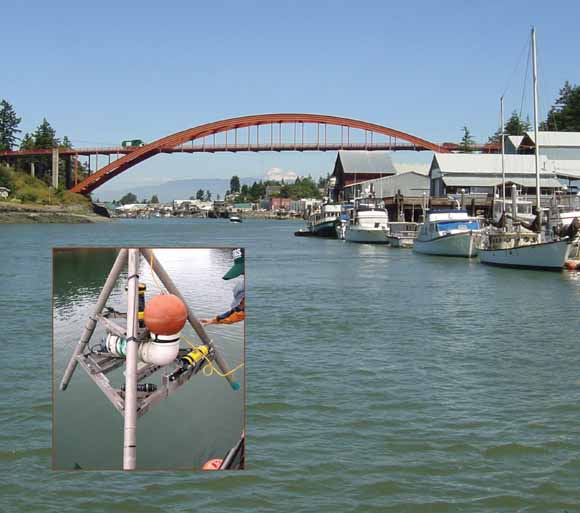
The Swinomish Channel in La Conner, Washington. Inset shows U.S. Geological Survey instrument tripod used to measure circulation and water-column properties. (Photographs by E. Grossman and A. Stevens, U.S. Geological Survey.)
Time-series and spatial measurements of nearshore hydrodynamic processes and water properties were made in the Swinomish Channel to quantify the net direction and rates of surface water transport that influence habitat for juvenile Chinook salmon along their primary migratory corridor between the Skagit River and Padilla Bay in northern Puget Sound, Washington. During the spring outmigration of Skagit River Chinook between March and June 2007, currents measured with fixed acoustic doppler current profilers (ADCP) at the south and north end of the Swinomish Channel and with roving ADCP revealed that the currents are highly asymmetric with a dominant flow to the north (toward Padilla Bay). Maximum surface current velocities reached 1.5 m/s and were generally uniform across the channel near McGlinn Island Causeway. Transport times for surface water to travel the 11 km from the southern end of Swinomish Channel at McGlinn Island to Padilla Bay ranged from 2.1 hours to 5.5 days. The mean travel time was ~1 day, while 17 percent of the time, transport of water and passive particles occurred within 3.75 hours. Surface water in the Swinomish Channel during this time was generally very saline 20-27 psu, except south of the Rainbow Bridge in the town of La Conner where it ranged 0-15 psu depending on tide and Skagit River discharge. This salinity regime restricts suitable low salinity (<15-20 psu) surface waters for fry Chinook salmon to the southernmost 2 km of the channel. The mean change in salinity along the channel was 10-13 psu. The high northward current velocities have the capacity to transport Chinook fry into less suitable, high-salinity waters toward Padilla Bay within hours. The rapid transport times of 2.1 to 3.75 hours between McGlinn Island and Padilla Bay that occur 17 percent of the time, are considerably less than the time considered adequate for juvenile Chinook to acclimate and produce a temporal salinity gradient for pre-smolt salmon that can exceed 4 psu/hour during high northward current flow.
Download this report as a 97-page PDF file (sir2007-5120.pdf; 14.2 MB).
For questions about the content of this report, contact Eric Grossman
Suggested citation and version history
Download a copy of the latest version of Adobe Reader for free.
|
Help |
PDF help |
Publications main page |
| Western Scientific Investigations Reports |
| Geography | Coastal and Marine Geology
|

![]() U.S. Department of the Interior | U.S. Geological Survey
U.S. Department of the Interior | U.S. Geological Survey
URL: https://pubs.usgs.gov/sir/2007/5120/
Page Contact Information: Michael Diggles
Page Last Modified: July 19, 2007