Scientific Investigations Report 2007-5211
Abstract
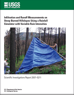
Multiple rainfall intensities were used in rainfall-simulation experiments designed to investigate the infiltration and runoff from 1-square-meter plots on burned hillslopes covered by an ash layer of varying thickness. The 1-square-meter plots were on north- and south-facing hillslopes in an area burned by the Overland fire northwest of Boulder near Jamestown on the Front Range of Colorado. A single-nozzle, wide-angle, multi-intensity rain simulator was developed to investigate the infiltration and runoff on steep (30- to 40-percent gradient) burned hillslopes covered with ash. The simulated rainfall was evaluated for spatial variability, drop size, and kinetic energy. Fourteen rainfall simulations, at three intensities (about 20 millimeters per hour [mm/h], 35 mm/h, and 50 mm/h), were conducted on four plots. Measurements during and after the simulations included runoff, rainfall, suspended-sediment concentrations, surface ash layer thickness, soil moisture, soil grain size, soil lost on ignition, and plot topography. Runoff discharge reached a steady state within 7 to 26 minutes. Steady infiltration rates with the 50-mm/h application rainfall intensity approached 20–35 mm/h. If these rates are projected to rainfall application intensities used in many studies of burned area runoff production (about 80 mm/h), the steady discharge rates are on the lower end of measurements from other studies. Experiments using multiple rainfall intensities (three) suggest that runoff begins at rainfall intensities around 20 mm/h at the 1-square-meter scale, an observation consistent with a 10-mm/h rainfall intensity threshold needed for runoff initiation that has been reported in the literature. |
Version 1.0 Posted March 2008 |
Kinner, D.A., and Moody, J.A., 2008, Infiltration and runoff measurements on steep burned hillslopes using a rainfall simulator with variable rain intensities: U.S. Geological Survey Scientific Investigations Report 2007–5211, 64 p.
Abstract
Introduction
Runoff from Burned Watersheds
Purpose and Scope of Study
Research Site
Methods
Types of Rainfall Simulators
Rainfall Simulator Design
Simulated Rainfall Calibration and Evaluation
Study Area Characteristics
Plot Experiments
Plot Topography and Stratigraphy
Rainfall Simulations
Soil Moisture
Overland Flow Velocities and Suspended Sediment
Simulated Rainfall Characteristics
Spatial Variability
Drop Characteristics
Incident Rainfall
Temporal Variability
Study Area
Topography
Surficial Features
Rainfall-Simulation Experiments
Plot Topography
Plot Stratigraphy
Ash and Soil Characteristics
Soil Moisture
Plot Runoff
Overland Flow Velocities and Flow Paths
Suspended Sediment
Summary
Acknowledgments
References
| Document Accessibility: Part or all of this report is presented in Portable Document Format (PDF); the latest version of Adobe Acrobat Reader or similar software is required to view it. Download the latest version of Acrobat Reader, free of charge or go to access.adobe.com for free tools that allow visually impaired users to read PDF files. |

![]() U.S. Department of the Interior | U.S. Geological Survey
U.S. Department of the Interior | U.S. Geological Survey
URL: http://pubsdata.usgs.gov/pubs/sir/2007/5211/index.html
Questions or Assistance: Contact USGS
Last modified: Thursday, 01-Dec-2016 20:00:52 EST
