Scientific Investigations Report 2007-5248
U.S. GEOLOGICAL SURVEY
Scientific Investigations Report 2007-5248
Prepared in cooperation with
Utah Department of Environmental Quality, Division of Water Quality
By Briant A. Kimball, Robert L. Runkel, and Katherine Walton-Day
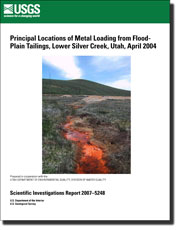
Because of the historical deposition of mill tailings in flood plains, the process of determining total maximum daily loads for streams in an area like the Park City mining district of Utah is complicated. Understanding the locations of metal loading to Silver Creek and the relative importance of these locations is necessary to make science-based decisions. Application of tracer-injection and synoptic-sampling techniques provided a means to quantify and rank the many possible source areas. A mass-loading study was conducted along a 10,000-meter reach of Silver Creek, Utah, in April 2004. Mass-loading profiles based on spatially detailed discharge and chemical data indicated five principal locations of metal loading. These five locations contributed more than 60 percent of the cadmium and zinc loads to Silver Creek along the study reach and can be considered locations where remediation efforts could have the greatest effect upon improvement of water quality in Silver Creek.
This report is available online in Portable Document Format (PDF). If you do not have the Adobe Acrobat PDF Reader, it is available for free download from Adobe Systems Incorporated.
Document Accessibility: Adobe Systems Incorporated has information about PDFs and the visually impaired. This information provides tools to help make PDF files accessible. These tools convert Adobe PDF documents into HTML or ASCII text, which then can be read by a number of common screen-reading programs that synthesize text as audible speech. In addition, an accessible version of Adobe Reader 8.0 for Windows (English only), which contains support for screen readers, is available. These tools and the accessible reader may be obtained free from Adobe at Adobe Access.
Send questions or comments about this report to the author, Briant A. Kimball, (801) 908-5047
For more information about USGS activities in Utah, visit the USGS Utah Water Science Center home page .

![]() U.S. Department of the Interior |
U.S. Geological Survey
U.S. Department of the Interior |
U.S. Geological Survey
URL: https://pubs.usgs.gov/sir/2007/5248
Page Contact Information: Publications Team
Page Last Modified: 02/27/08
