 Abstract Abstract
Power-law equations that are physically motivated and statistically tested and calibrated provide a basis for forecasting areas likely to be inundated by debris flows, rock avalanches, and lahars with diverse volumes. The equations A=α1V2/3 and B=α2V2/3 are based on the postulate that the maximum valley cross-sectional area (A) and total valley planimetric area (B) likely to be inundated by a flow depend only on its volume (V) and the topography of the flow path. Testing of these equations involves determining whether or not they fit data for documented flows satisfactorily, and calibration entails determining best-fit values of the coefficients α1 and α2 for debris flows, rock avalanches, and lahars. This report describes statistical testing and calibration of the equations by using field data compiled from many sources, and it describes application of the equations to delineation of debris-flow hazard zones.
Statistical results show that for each type of flow (debris flows, rock avalanches, and lahars), the dependence of A and B on V is described well by power laws with exponents equal to 2/3. This value of the exponent produces fits that are effectively indistinguishable from the best fits obtained by using adjustable power-law exponents. Statistically calibrated values of the coefficients α1 and α2 provide scale-invariant indices of the relative mobilities of rock avalanches (α1 = 0.2, α2 = 20), nonvolcanic debris flows (α1 = 0.1, α2 = 20), and lahars
(α1 = 0.05, α2 = 200). These values show, for example, that a lahar of specified volume can be expected to inundate a planimetric area ten times larger than that inundated by a rock avalanche or nonvolcanic debris flow of the same volume..
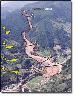
The utility of the calibrated debris-flow inundation equations A=0.1V2/3 and B=20V2/3 is demonstrated by using them within the GIS program LAHARZ to delineate nested hazard zones for future debris flows in an area bordering the Umpqua River in the south-central Oregon Coast Range. This application requires use of high-resolution topographic data derived form LIDAR surveys, knowledge of local geology to specify a suitable range of prospective debris-flow volumes, and development and use of a new algorithm for identification of prospective debris-flow source areas in finely dissected terrain.
|
Part or all of this report is presented in Portable Document Format (PDF). For best results viewing and printing PDF documents, it is recommended that you download the documents to your computer and open them with Adobe Reader. PDF documents opened from your browser may not display or print as intended. Download the latest version of Adobe Reader, free of charge.
|

