Scientific Investigations Report 2008-5051
 Contents | Citation
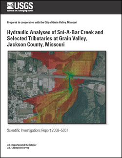
 AbstractA study was done by the U.S. Geological Survey, in cooperation with the city of Grain Valley, Jackson County, Missouri, to simulate the hydraulic characteristics of Sni-A-Bar Creek and selected tributaries within the corporate limits. The 10-, 50-, 100-, and 500-year recurrence interval streamflows were simulated to determine potential backwater effects on the Sni-A-Bar Creek main stem and to delineate flood-plain boundaries on the tributaries. The water-surface profiles through the bridge structures within the model area indicated that backwater effects from the constrictions were not substantial. The water-surface profile of Sni-A-Bar Creek generated from the one- and two-dimensional models indicated that the Gateway Western Railroad structure provided the greatest amount of contraction of flow within the modeled area. The results at the location of the upstream face of the railroad structure indicated a change in water-surface elevation from 0.2 to 0.8 foot (corresponding to simulated 10-year and 500-year flood occurrences). Results from all analyses indicated minimal backwater effects as a result of an overall minimal energy grade line slope and velocity head along Sni-A-Bar Creek. The flood plains for the 100-year recurrence interval floods on the Sni-A-Bar tributaries were mapped to show the extent of inundated areas. The updated flooding characteristics will allow city managers to contrast changes in flood risk and zoning as determined through the National Flood Insurance Program. |
Posted April 2008
Download report (9.5 MB pdf) Films: film1_10-yr-focus (63 MB zip file) film2_50-yr-focus (64 MB zip file) film3_100-yr-focus (63 MB zip file) film4_500-yr-focus (63 MB zip file) film5_10-yr_full (57 MB zip file) film6_50-yr_full (57 MB zip file) film7_100-yr_full (52 MB zip file) film8_500-yr_full (57 MB zip file) README.txt (2 kB txt file) These films have been compressed using the software WinZip®. The files should first be downloaded and extracted using WinZip® software available at winzip.com. |
Abstract
Introduction
Purpose and Scope
Description of Study Area
Methods
Development of One-Dimensional Models
Cross Sections and Extent of Models
Cross-Section Attributes
Topographic Information
HEC-RAS Model Boundary Conditions
Bridges and Culverts
HEC-RAS Model Calibration
Development of the Two-Dimensional Model
FESWMS Model Calibration
Sources of Errors in HEC-RAS and FESWMS Models
Hydraulic Analyses of Sni-A-Bar Creek (HEC-RAS Results)
Hydraulic Analyses of Sni-A-Bar Creek (FESWMS Results)
Hydraulic Analyses of Sni-A-Bar Creek Tributaries
Hydraulic Structures Performance
Flood Plain Determination
Summary
References Cited
Rydlund, P.H., Jr., Otero-Benítez, W. and Heimann, D.C., 2008, Hydraulic analyses of Sni-A-Bar Creek and selected tributaries at Grain Valley, Jackson County, Missouri: U.S. Geological Survey Scientific Investigations Report 2008–5051, 57 p. plus films.

![]() U.S. Department of the Interior | U.S. Geological Survey
U.S. Department of the Interior | U.S. Geological Survey
URL: http://pubsdata.usgs.gov/pubs/sir/2008/5051/index.html
Questions or Assistance: Contact USGS
Last modified: Thursday, 10-Jan-2013 18:44:47 EST
