Scientific Investigations Report 2008–5076
U.S. GEOLOGICAL SURVEY
Scientific Investigations Report 2008–5076
The inflows to the UKL/Agency Lake hydrologic system include the Williamson River, the Wood River, the Fourmile and Sevenmile Canals, precipitation, and ground water. The biggest tributary is the Williamson River, which flows into UKL north of Eagle Ridge on the opposite shore (fig. 1). The Williamson River streamflow gage is located at river mile 10.3; daily values from the gage were used as input to the model (USGS site 11502500, fig. 1; Herrett and others, 2006; U.S. Geological Survey, 2007). Daily values of inflow from the next three largest tributaries—the Wood River, Sevenmile Canal, and Fourmile Canal—were provided by Graham Matthews and Associates (GMA) for 2005 (Cort Pryor, Graham Matthews and Associates, oral commun., 2006). These three tributaries empty into Agency Lake from the Wood River Valley (fig. 1). In 2005, the discharge at Fourmile Canal was estimated from August 13 through the end of the water year because equipment at the site failed. In 2006, daily values of inflow at Sevenmile Canal were provided by GMA (Cort Pryor, Graham Matthews and Associates, oral commun., 2006), but daily values were unavailable at either the Wood River or the Fourmile Canal. The discharge from these two sites was set to 3 m3/s and 5 m3/s, respectively, which was the approximate base flow based on the 2005 data. The remainder of the discharge from those two tributaries, which probably was substantial only during the early part of the summer, became part of the calculation of ungaged inputs during 2006 (fig. 4).
Daily precipitation data were collected at the Bureau of Reclamation (2008) Pacific Northwest Cooperative Agricultural Weather Network (AgriMet) site located near Agency Lake (AGKO, fig. 1). Because the UnTRIM model of UKL does not accommodate precipitation as a distributed input, one-third of the daily precipitation was added to the Wood River inflow, and two-thirds was added to the Williamson River inflow.
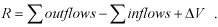
The ungaged inflows to the lake, including ground-water inflows, were calculated by using the daily lake stage (USGS site 11507001), which is a weighted average of the stage measured at three sites around the lake at Rattlesnake Point, Rocky Point, and Klamath Falls (fig. 1), and the volume of the lake as a function of lake stage, which was calculated from the same bathymetry used to create the model grid. This bathymetry is based on a survey of approximately 94,200 soundings done in May and June of 1996. These soundings were oriented in east/west transects, providing a 200-m north/south spacing between the transects, and were thinned to a minimum of 50-m spacing along the transects (M. Neuman, Bureau of Reclamation, oral commun., 2007). If the change in volume of the lake at each time step is denoted ΔV, then the ungaged inflow, R, at each time step is calculated as:
 (31)
(31)
The ungaged inflow is sometimes large compared to inflow from tributaries to the lake, particularly in the spring and early summer, and at other times is negative, indicating ungaged outflow rather than inflow (fig. 5). It is also, at times, large when compared to the estimate of 8.5 m3/s of ground-water inflow to the lake (Hubbard, 1970). Within the model, when the ungaged inflow is positive it is added to the Wood River Valley inflows. When the ungaged inflow is negative (indicating ungaged outflow) it is added to the Link River discharge at the outlet of the lake. It is apparent that the gaged inflows to and outflows from the lake are not sufficient to close the water balance with high accuracy. The method used for calculating the ungaged inflow and applying it to the model assures, however, that a mass balance of water in the model is achieved.
The outflow from the lake at the Link River is gaged by the USGS (site ID 11507500; fig. 1). Daily values were used as input to the model. This gaged discharge does not include the portion of the flow that, prior to 2005, was diverted for power generation through a canal that ultimately discharges back into the Link River downstream of the gage. In 2005, no water was diverted through the power canal, so the discharge at the gage is an accurate measure of the total flow over the Link River Dam. In 2006, there may have been diversions through the power canal, but the discharge measurements through the canal were unavailable and, therefore, were incorporated into the model as an ungaged outflow (fig. 5).
The A canal (fig. 1) diverts water for irrigation from the southern end of the lake above the Link River dam. The flow through the A canal is gaged by the Klamath Irrigation District and the daily values were obtained from the Bureau of Reclamation (Paul Gregory, Bureau of Reclamation, oral commun., 2007).
Daily evaporation data were collected at the AgriMet site located near Agency Lake (AGKO, fig. 1) (Bureau of Reclamation, 2008). Because the UnTRIM model of UKL does not accommodate evaporation as a distributed outflow, the daily evaporation was added to the Link River outflow.
Wind data were collected during 2005 and 2006 at two sites located on the lake and four sites located around the shoreline (fig. 1). After July 26, 2005, reliable data were available from at least five of the six sites (Hoilman and others, 2008). Prior to July 26, however, wind data were available from fewer sites. For this reason, three types of wind forcing covering different periods were used to run model simulations in 2005 (table 2). From June 8 (when the raft-mounted wind sensor at MDL was deployed in the lake at the beginning of the field season) to August 31 (when the wind sensors at MDL failed), the model was forced with a spatially uniform wind as measured at site MDL (denoted the UW-MDL simulation). From July 26 to October 12 (when the rafts on the lake were removed at the end of the field season), the model was forced with a spatially variable wind, interpolated as described above between sites on and around the lake (denoted the VW simulation). This resulted in an overlap period in midsummer between July 26 and August 31 for which these two simulations could be compared. To provide an additional comparison, during the same overlap period the model was forced with a spatially uniform wind as measured at site MDN (denoted the UW-MDN simulation). During 2006, wind data were available from six sites and a spatially variable wind forcing was used between May 20 and October 17. All meteorological data were collected as 15-minute averages in 2005 and 10-minute averages in 2006.
Air temperature and relative humidity were measured at five sites—WMR-MET, BLB-MET, HDB-MET, SSHR-MET, and MDL. Shortwave solar radiation was measured at sites WMR-MET and SSHR-MET. The measurements of air temperature and relative humidity at site MDL were used in these simulations with the exception of the period following September 4, 2005, when the sensors at site MDL failed. After September 4, 2005, the air-temperature data measured at the land-based station WMR-MET were used. The measurements of solar radiation from site WMR-MET were used in the simulations, with the exception of a few days prior to June 15, 2005, when the data from site WMR-MET were not yet available; solar data from the AgriMet site at Agency Lake (Bureau of Reclamation, 2008) were used for those days.
USGS water-level gage data collected at three sites around the lake were used for water-level calibration. The sites were Upper Klamath Lake at Rocky Point (site ID 11505800), Upper Klamath Lake at Rattlesnake Point (site ID 11505900), and Upper Klamath Lake at Klamath Falls (site ID 11507000, fig. 1).
Data used for calibration of water velocity came from five acoustic Doppler current profilers (ADCPs) deployed in the lake in 2005 and two ADCPs deployed in 2006 (fig. 1). These instruments and the velocity measurements collected have been described elsewhere (Gartner and others, 2007). Half-hourly velocity data were collected from the ADCPs between June 21 and September 12 in 2005, and between May 24 and September 25 in 2006. On July 5, 2006, the ADCP located at site ADCP1 was dragged by a barge from its initial deployment location to a location approximately 280 m away, where the meter continued to collect data.
The data used for water temperature calibration in this report have been described elsewhere (Hoilman and others, 2008). These data were measured at 13 sites (1 m from the top and 1 m from the bottom at 3 sites) in 2005 and 12 sites (1 m from the top and 1 m from the bottom at 4 sites) in 2006 (fig. 1). At 3 of these sites in 2005 and 4 of these sites in 2006, a water-quality monitor was placed at 1 m from the surface and 1 m from the bottom, resulting in a total of 16 water-quality monitors in both years. At sites where only one monitor was used, it was placed at 1 m from the bottom or at the middle of the water column if the total depth was 2 m or less. Hourly data were collected from the 16 water-quality monitors between June 3 and October 11, 2005, and between May 15 and October 16, 2006. Five additional sites were added within 100 m of the shoreline in 2006, starting on June 14 (fig. 1, table 2).
The extinction coefficient used in the model was determined from weekly vertical profiles of photosynthetically active radiation (PAR) at six water-quality monitoring sites. Light intensity was measured from the water surface to 2.5 m depth (or the lake bottom) in 0.5 m increments with a LiCor LI-193 spherical quantum sensor. These measurements were used to estimate the extinction coefficient by fitting an exponential relation based on Beer’s Law to the vertical profile of the light meter readings. The methods are described in more detail by Hoilman and others (2008). A mean value of the extinction coefficient was used in the simulations presented in this report, which was obtained as a spatial and temporal average of the measured values for July and August of 2005 at all six sites.
The vertical profiles of light intensity were collected to support a weekly program of light and dark bottle incubations in 2005 and 2006. Calculations based on some of these data that were collected in 2006 are presented below in the discussion of the role of currents in determining water quality in the lake. The values of production and consumption obtained from the bottle incubations were converted to a change in dissolved oxygen concentration over a 24-hour period as detailed in Appendix A. Further details of data-collection methods are provided by Hoilman and others (2008).
The single value for the fraction of the sky covered by clouds that was used in the model simulations is the long term July-August average at the Medford, Oregon, airport (Oregon Climate Service, 2008). Because Medford is located about 130 km to the west of Klamath Falls and at about 830 m lower elevation, the daily values of cloud cover collected there are not expected to be accurate for Klamath Falls. The months of July and August in Klamath Falls are generally quite clear, but weather patterns in the spring and fall can result in periods of several cloudy days at a time. However, cloud cover is used only in the calculation of incoming longwave radiation (eq. 24), and the errors associated with using a constant value are expected to be small.

![]() U.S. Department of the Interior | U.S. Geological Survey
U.S. Department of the Interior | U.S. Geological Survey
URL: http://pubs.usgs.gov/sir/2008/5076
Page Contact Information: Publications Team
Page Last Modified: Thursday, 10-Jan-2013 18:48:17 EST
