U.S. Geological Survey Scientific Investigations Report 2008-5113
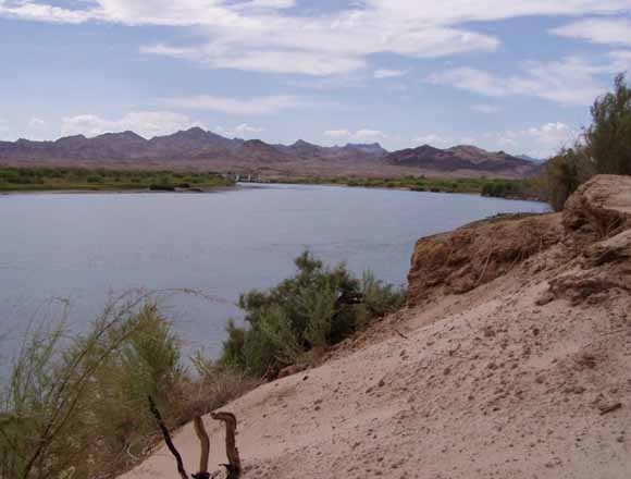
Looking upstream at Palo Verde Dam on the Colorado River near Blythe, California. Photo taken by Sandra J. Owen-Joyce, July 25, 2007.
The accounting-surface method was developed in the 1990s by the U.S. Geological Survey, in cooperation with the Bureau of Reclamation, to identify wells outside the flood plain of the lower Colorado River that yield water that will be replaced by water from the river. This method was needed to identify which wells require an entitlement for diversion of water from the Colorado River and need to be included in accounting for consumptive use of Colorado River water as outlined in the Consolidated Decree of the United States Supreme Court in Arizona v. California. The method is based on the concept of a river aquifer and an accounting surface within the river aquifer. The study area includes the valley adjacent to the lower Colorado River and parts of some adjacent valleys in Arizona, California, Nevada, and Utah and extends from the east end of Lake Mead south to the southerly international boundary with Mexico. Contours for the original accounting surface were hand drawn based on the shape of the aquifer, water-surface elevations in the Colorado River and drainage ditches, and hydrologic judgment. This report documents an update of the original accounting surface based on updated water-surface elevations in the Colorado River and drainage ditches and the use of simple, physically based ground-water flow models to calculate the accounting surface in four areas adjacent to the free-flowing river.
Download the text of this report as a 24-page PDF file (sir2008-5113_text.pdf; 20.6 MB)
There are three appendixes to this report; they are provided here as Excel (.xls), comma-separated value (.csv), tab-delimited ASCII (.txt), and PDF (.pdf) files.
Go to the Appendixes folder (appendixes; 568 kB total)
There are three plates to this report; they are provided here as PDF (.pdf) files.
Go to the Plates folder (plates; 75 MB total)
View the Readme file (sir2008-5113_readme.txt; 8 kB)
Download the metadata (LCR_Accounting_Surface_metadata.zip; 128 kB compressed file that opens to a folder that containa 26 files, 584 kB total)
Download the data as shapefiles (sir2008-5113_shapefiles.tar.gz; 9.3 MB compressed file that opens to a 9.7 MB folder)
For additional information contact:
Office information, Arizona Water Science Center
U.S. Geological Survey
520 N. Park Avenue
Tucson, AZ 85719
http://az.water.usgs.gov/
Suggested citation and version history
Download a free copy of the latest version of Adobe Reader.
|
Help |
PDF help |
Publications main page |
| Western Scientific Investigations Reports |
| Water Resources |
Arizona Water Science Center
|
This report is available only on the Web

![]() U.S. Department of the Interior |
U.S. Geological Survey
U.S. Department of the Interior |
U.S. Geological Survey
URL: https://pubsdata.usgs.gov/pubs/sir/2008/5113/
Page Contact Information: USGS Publications Team
Page Last Modified: Thursday, 10-Jan-2013 18:50:19 EST
