Arizona Water Science Center
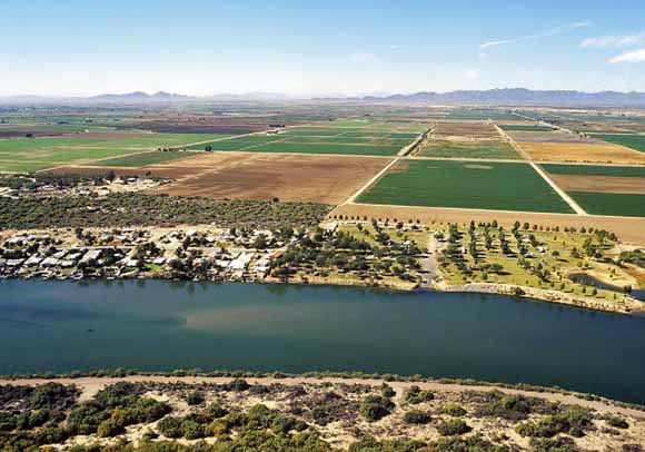
The Lower Colorado River and adjacent farmland. Photograph from the Bureau of Reclamation.
According to the Law of the River, wells that draw water from the Colorado River by underground pumping need an entitlement for the diversion of water from the Colorado River. Consumptive use can occur through direct diversions of surface water, as well as through withdrawal of water from the river by underground pumping. To develop methods for evaluating the need for entitlements for Colorado River water, an assessment of possible depletion of water in the Colorado River by pumping wells is needed. Possible methods include simple analytical models and complex numerical ground-water flow models. For this study, an intermediate approach was taken that uses numerical superposition models with complex horizontal geometry, simple vertical geometry, and constant aquifer properties. The six areas modeled include larger extents of the previously defined river aquifer from the Lake Mead area to the Yuma area. For the modeled areas, a low estimate of transmissivity and an average estimate of transmissivity were derived from statistical analyses of transmissivity data. Aquifer storage coefficient, or specific yield, was selected on the basis of results of a previous study in the Yuma area. The USGS program MODFLOW-2000 (Harbaugh and others, 2000) was used with uniform 0.25-mile grid spacing along rows and columns. Calculations of depletion of river water by wells were made for a time of 100 years since the onset of pumping. A computer program was set up to run the models repeatedly, each time with a well in a different location. Maps were constructed for at least two transmissivity values for each of the modeled areas. The modeling results, based on the selected transmissivities, indicate that low values of depletion in 100 years occur mainly in parts of side valleys that are more than a few tens of miles from the Colorado River.
Download the text of this report as a 32-page PDF file (sir2008-5189.pdf; 4.1 MB)
Depletion Contours; ZIP file (PublicationDepletionFiles.zip; 2.6-MB file that opens to a 4.8-MB folder)
For questions about the content of this report, contact Stanley Leake
Suggested citation and version history
Download a free copy of the latest version of Adobe Reader.
|
Help |
PDF help |
Publications main page |
| Western Scientific Investigations Reports |
| Water Resources |
Arizona Water Science Center
|
This report is available only on the Web

![]() U.S. Department of the Interior | U.S. Geological Survey
U.S. Department of the Interior | U.S. Geological Survey
URL: http://pubs.usgs.gov/sir/2008/5189/
Page Contact Information: Michael Diggles
Page Created: October 29, 2008
Page Last Modified: March 3, 2011 (mfd)