 ABSTRACT
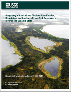
Lakes are abundant landforms and important ecosystems in Alaska, but are unevenly distributed on the landscape with expansive lake-poor regions and several lake-rich regions. Such lake-rich areas are termed lake districts and have landscape characteristics that can be considered distinctive in similar respects to mountain ranges. In this report, we explore the nature of lake-rich areas by quantitatively identifying Alaska’s lake districts, describing and comparing their physical characteristics, and analyzing how Alaska lake districts are naturally organized and correspond to climatic and geophysical characteristics, as well as studied and managed by people.
We use a digital dataset (National Hydrography Dataset) of lakes greater than 1 hectare, which includes 409,040 individual lakes and represents 3.3 percent of the land-surface area of Alaska. The selection criteria we used to identify lake districts were (1) a lake area (termed limnetic ratio, in percent) greater than the mean for the State, and (2) a lake density (number of lakes per unit area) greater than the mean for the State using a pixel size scaled to the area of interest and number of lakes in the census. Pixels meeting these criteria were grouped and delineated and all groups greater than 1,000 square kilometers were identified as Alaska’s lake districts. These lake districts were described according to lake size-frequency metrics, elevation distributions, geology, climate, and ecoregions to better understand their similarities and differences. We also looked at where lake research and relevant ecological monitoring has occurred in Alaska relative to lake districts and how lake district lands and waters are currently managed.
We identified and delineated 20 lake districts in Alaska representing 16 percent of the State, but including 65 percent of lakes and 75 percent of lake area. The largest lake districts identified are the Yukon-Kuskokwim Delta, Arctic Coastal Plain, and Iliamna lake districts with high limnetic ratios of 19, 17, and 21 percent, respectively. The three smallest districts we considered were Tetlin in the eastern interior, Menhiskof on the Alaska Peninsula, and Matanuska–Susitna at the head of Cook Inlet with limnetic ratios of 14, 9, and 9 percent, respectively. Lake density and limnetic ratio were poorly related among lake districts, such that some districts had a few large lakes like Iliamna with Lakes Iliamna and Becharof—the two largest in the State, compared to other districts with many very small lakes like Yukon-Kuskokwim Delta with 111,130 lakes and 63 percent of these less than 10 hectares. Most lake districts are in regions with relatively low precipitation, but temperature regimes varied widely among lake districts. Approximately one-half of lake districts were glaciated during the Pleistocene and similar numbers occur in regions classified as having continuous, discontinuous, and sporadic permafrost, or perennially unfrozen soils. Most districts are at low elevations (less than 250 meters) with two important exceptions being Tetlin with a mean elevation of 530 meters and Ahtna with a mean elevation of 760 meters. These higher elevation districts, particularly Ahtna, had distinct characteristics from other lake districts such as continuous permafrost and Pleistocene glaciation. Several lake districts share similar boundaries to defined ecoregions with lake districts occurring in less than one-half of these 32 ecoregions of Alaska.
Most lake districts are lands fully or partly managed by the U.S. Fish and Wildlife Service and the National Park Service, with other land management by the Bureau of Land Management and State and borough government. Much of the U.S. Geological Survey’s lake water-quality sampling efforts has been done in the Arctic Coastal Plain, Matanuska-Susitna, and Iliamna districts but no recorded collections in nine lake districts. Similarly, most lake limnological studies in Alaska were site-specific and represent only a small portion of Alaska’s lake districts. This identification, characterization, and analysis of lake-rich regions may help provide a template to guide future limnological and other scientific research for Alaska.

