Scientific Investigations Report 2008-5234
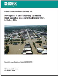
ABSTRACTDigital flood-inundation maps of the Blanchard River in Findlay, Ohio, were created by the U.S. Geological Survey (USGS) in cooperation with the City of Findlay, Ohio. The maps, which correspond to water levels at the USGS streamgage at Findlay (04189000), were provided to the National Weather Service (NWS) for incorporation into a Web-based flood-warning system that can be used in conjunction with NWS flood-forecast data to show areas of predicted flood inundation associated with forecasted flood-peak stages. The USGS reestablished one streamgage and added another on the Blanchard River upstream of Findlay. Additionally, the USGS established one streamgage each on Eagle and Lye Creeks, tributaries to the Blanchard River. The stream-gage sites were equipped with rain gages and multiple forms of telemetry. Data from these gages can be used by emergency management personnel to determine a course of action when flooding is imminent. Flood profiles computed by means of a step-backwater model were prepared and calibrated to a recent flood with a return period exceeding 100 years. The hydraulic model was then used to determine water-surface-elevation profiles for 11 flood stages with corresponding streamflows ranging from approximately 2 to 100 years in recurrence interval. The simulated flood profiles were used in combination with digital elevation data to delineate the flood-inundation areas. Maps of Findlay showing flood-inundation areas overlain on digital orthophotographs are presented for the selected floods. |
Part or all of this report is presented in Portable Document Format (PDF); the latest version of Adobe Reader or similar software is required to view it. Download the latest version of Adobe Reader, free of charge. |
Whitehead, M.T., and Ostheimer, C.J., 2009, Development of a flood-warning system and flood-inundation mapping for the Blanchard River in Findlay, Ohio: U.S. Geological Survey Scientific Investigations Report 2008–5234, 9 p., available online at http://pubs.usgs.gov/sir/2008/5234/.
Abstract
Introduction
Description of the Study Area
Purpose and Scope
Installation and Upgrades of Streamgages for a Flood-Warning System
Hydrology and Hydraulics
Previous Study
Calibration of Model to August 2007 Flood
Development of Profiles
Development of Flood-Inundation Maps
Backwater Mapping
Alternate Flow Scenario
Summary
Acknowledgments
References

![]() U.S. Department of the Interior |
U.S. Geological Survey
U.S. Department of the Interior |
U.S. Geological Survey
URL: https://pubsdata.usgs.gov/pubs/sir/2008/5234/
Page Contact Information: Contact USGS
Page Last Modified: Thursday, 10-Jan-2013 19:03:09 EST
