Scientific Investigations Report 2009–5026
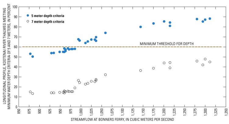
Figure 13. Streamflow and percentage of thalweg longitudinal profile achieving a minimum water depth of 5 and 7 meters between river kilometer 244.6 and 252.7, Kootenai River near Bonners Ferry, Idaho, May 18–June 5, 2006, and May 22–June 5, 2007. |
For additional information contact: Part or all of this report is presented in Portable Document Format (PDF); the latest version of Adobe Reader or similar software is required to view it. Download the latest version of Adobe Reader, free of charge. |

![]() U.S. Department of the Interior | U.S. Geological Survey
U.S. Department of the Interior | U.S. Geological Survey
URL: http://
pubsdata.usgs.gov
/pubs/sir/2009/5026/figure13.html
Page Contact Information: Contact USGS
Page Last Modified:
Thursday, 10-Jan-2013 19:41:25 EST
