Scientific Investigations Report 2009–5104
ABSTRACT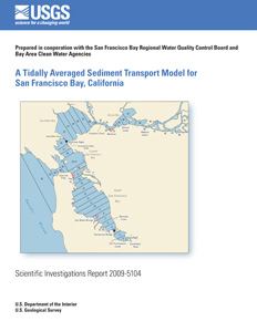
A tidally averaged sediment-transport model of San Francisco Bay was incorporated into a tidally averaged salinity box model previously developed and calibrated using salinity, a conservative tracer (Uncles and Peterson, 1995; Knowles, 1996). The Bay is represented in the model by 50 segments composed of two layers: one representing the channel (>5-meter depth) and the other the shallows (0- to 5-meter depth). Calculations are made using a daily time step and simulations can be made on the decadal time scale. The sediment-transport model includes an erosion-deposition algorithm, a bed-sediment algorithm, and sediment boundary conditions. Erosion and deposition of bed sediments are calculated explicitly, and suspended sediment is transported by implicitly solving the advection-dispersion equation. The bed-sediment model simulates the increase in bed strength with depth, owing to consolidation of fine sediments that make up San Francisco Bay mud. The model is calibrated to either net sedimentation calculated from bathymetric-change data or measured suspended-sediment concentration. Specified boundary conditions are the tributary fluxes of suspended sediment and suspended-sediment concentration in the Pacific Ocean. Results of model calibration and validation show that the model simulates the trends in suspended-sediment concentration associated with tidal fluctuations, residual velocity, and wind stress well, although the spring neap tidal suspended-sediment concentration variability was consistently underestimated. Model validation also showed poor simulation of seasonal sediment pulses from the Sacramento–San Joaquin River Delta at Point San Pablo because the pulses enter the Bay over only a few days and the fate of the pulses is determined by intra-tidal deposition and resuspension that are not included in this tidally averaged model. The model was calibrated to net-basin sedimentation to calculate budgets of sediment and sediment-associated contaminants. While simulated net sedimentation in the four basins that comprise San Francisco Bay was correct, the simulations incorrectly eroded shallows while channels deposited because model surface-layer boxes span both shallows and channels, and neglect lateral variability of suspended-sediment concentration. Validation with recent (1983–2005) net sedimentation in South San Francisco Bay was poor, perhaps owing to poorly quantified sediment supply, and to invasive species that altered erosion and deposition processes. This demonstrates that deterministically predicting future sedimentation is difficult in this or any estuary for which boundary conditions are not stationary. The model would best be used as a tool for developing past and present sediment budgets, and for creating scenarios of future sedimentation that are compared to one another rather than considered a deterministic prediction. |
For additional information contact: Part or all of this report is presented in Portable Document Format (PDF); the latest version of Adobe Reader or similar software is required to view it. Download the latest version of Adobe Reader, free of charge. |
Lionberger, M.A., and Schoellhamer, D.H., 2009, A tidally averaged sediment-transport model for San Francisco Bay, California: U.S. Geological Survey Scientific Investigations Report 2009–5104, 23 p.
Abstract
Introduction
Uncles-Peterson Salinity Model
Sediment-Transport Model
Conclusions
Ackowledgments
References Cited
Appendix

![]() U.S. Department of the Interior |
U.S. Geological Survey
U.S. Department of the Interior |
U.S. Geological Survey
URL: http://
pubsdata.usgs.gov
/pubs/sir/2009/5104/index.html
Page Contact Information: USGS Publications Team
Page Last Modified: Thursday, 10-Jan-2013 19:33:05 EST
