Scientific Investigations Report 2009–5227
ABSTRACT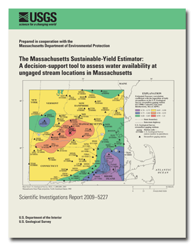
Federal, State and local water-resource managers require a variety of data and modeling tools to better understand water resources. The U.S. Geological Survey, in cooperation with the Massachusetts Department of Environmental Protection, has developed a statewide, interactive decision-support tool to meet this need. The decision-support tool, referred to as the Massachusetts Sustainable-Yield Estimator (MA SYE) provides screening-level estimates of the sustainable yield of a basin, defined as the difference between the unregulated streamflow and some user-specified quantity of water that must remain in the stream to support such functions as recreational activities or aquatic habitat. The MA SYE tool was designed, in part, because the quantity of surface water available in a basin is a time-varying quantity subject to competing demands for water. To compute sustainable yield, the MA SYE tool estimates a daily time series of unregulated, daily mean streamflow for a 44-year period of record spanning October 1, 1960, through September 30, 2004. Selected streamflow quantiles from an unregulated, daily flow-duration curve are estimated by solving six regression equations that are a function of physical and climate basin characteristics at an ungaged site on a stream of interest. Streamflow is then interpolated between the estimated quantiles to obtain a continuous daily flow-duration curve. A time series of unregulated daily streamflow subsequently is created by transferring the timing of the daily streamflow at a reference streamgage to the ungaged site by equating exceedence probabilities of contemporaneous flow at the two locations. One of 66 reference streamgages is selected by kriging, a geostatistical method, which is used to map the spatial relation among correlations between the time series of the logarithm of daily streamflows at each reference streamgage and the ungaged site. Estimated unregulated, daily mean streamflows show good agreement with observed unregulated, daily mean streamflow at 18 streamgages located across southern New England. Nash-Sutcliffe efficiency goodness-of-fit values are between 0.69 and 0.98, and percent root-mean-square-error values are between 19 and 283 percent. The MA SYE tool provides an estimate of streamflow adjusted for current (2000–04) water withdrawals and discharges using a spatially referenced database of permitted groundwater and surface-water withdrawal and discharge volumes. For a user-selected basin, the database is queried to obtain the locations of water withdrawal or discharge volumes within the basin. Groundwater and surface-water withdrawals and discharges are subtracted and added, respectively, from the unregulated, daily streamflow at an ungaged site to obtain a streamflow time series that includes the effects of these withdrawals and discharges. Users also have the option of applying an analytical solution to the time-varying, groundwater withdrawal and discharge volumes that take into account the effects of the aquifer properties on the timing and magnitude of streamflow alteration. For the MA SYE tool, it is assumed that groundwater and surface-water divides are coincident. For areas of southeastern Massachusetts and Cape Cod where this assumption is known to be violated, groundwater-flow models are used to estimate average monthly streamflows at fixed locations. There are several limitations to the quality and quantity of the spatially referenced database of groundwater and surface-water withdrawals and discharges. The adjusted streamflow values do not account for the effects on streamflow of climate change, septic-system discharge, impervious area, non-public water-supply withdrawals less than 100,000 gallons per day, and impounded surface-water bodies. Suggested citation:Archfield, S.A., Vogel, R.M., Steeves, P.A., Brandt, S.L., Weiskel, P.K., and Garabedian, S.P., 2010, The Massachusetts Sustainable-Yield Estimator: A decision-support tool to assess water availability at ungaged stream locations in Massachusetts: U.S. Geological Survey Scientific Investigations Report 2009–5227, 41 p. plus CD-ROM. ContentsAbstract Introduction Safe versus Sustainable Yield Existing Tools to Estimate Streamflow and Assess Water Availability in Massachusetts Purpose and Scope Estimation of Unregulated, Daily Mean Streamflow Estimation of a Continuous Flow-Duration Curve at Ungaged Sites Streamgages, Flow-Duration-Curve Statistics, and Basin Characteristics Regression against Basin Characteristics Regression against Streamflow Quantiles Estimation of Streamflow Time Series by use of a Reference Streamgage Reference Streamgages Selection of a Reference Streamgage Comparison of Observed and Estimated Streamflows Uncertainty of Estimated Streamflows Streamflow Adjusted for Groundwater and Surface-Water Withdrawals and Discharges Reported Groundwater and Surface-Water Withdrawals and Discharges Disaggregation of Withdrawal and Discharge Volumes Use of the STRMDEPL Program Estimation of Streamflow when Groundwater and Surface-Water Divides are not Coincident Calculation of Sustainable Yields Using the Massachusetts Sustainable-Yield Estimator (MA SYE) Tool Limitations Summary Acknowledgments References Cited Appendix 1. Statewide maps of selected basin characteristics used to estimate
unregulated, daily streamflows |
First posted January 2010
Appendix 1
Revised August 27, 2010
Posted June 2010 For additional information contact: Part or all of this report is presented in Portable Document Format (PDF); the latest version of Adobe Reader or similar software is required to view it. Download the latest version of Adobe Reader, free of charge. |

![]() U.S. Department of the Interior |
U.S. Geological Survey
U.S. Department of the Interior |
U.S. Geological Survey
URL: https://pubsdata.usgs.gov/pubs/sir/2009/5227/
Page Contact Information: Contact USGS
Page Last Modified: Thursday, 08-Feb-2018 12:14:30 EST
