Skip Links
Scientific Investigations Report 2010–5022
Prepared in cooperation with the
PUERTO RICO DEPARTMENT OF NATURAL AND ENVIRONMENTAL RESOURCES AND
THE JOBOS BAY NATIONAL ESTUARINE RESEARCH RESERVE
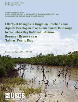
Effects of Changes in Irrigation Practices and Aquifer Development on Groundwater Discharge to the Jobos Bay National Estuarine Research Reserve near Salinas, Puerto Rico
By Eve L. Kuniansky and José M. Rodríguez

Abstract
Since 1990, about 75 acres of black mangroves have died in the Jobos Bay National Estuarine Research Reserve near Salinas, Puerto Rico. Although many factors can contribute to the mortality of mangroves, changes in irrigation practices, rainfall, and water use resulted in as much as 25 feet of drawdown in the potentiometric surface of the aquifer in the vicinity of the reserve between 1986 and 2002. To clarify the issue, the U.S. Geological Survey, in cooperation with the Puerto Rico Department of Natural and Environmental Resources, conducted a study to ascertain how aquifer development and changes in irrigation practices have affected groundwater levels and groundwater flow to the Mar Negro area of the reserve.
Changes in groundwater flow to the mangrove swamp and bay from 1986 to 2004 were estimated in this study by developing and calibrating a numerical groundwater flow model. The transient simulations indicate that prior to 1994, high irrigation return flows more than offset the effect of reduced groundwater withdrawals. In this case, the simulated discharge to the coast in the modeled area was 19 million gallons per day. From 1994 through 2004, furrow irrigation was completely replaced by micro-drip irrigation, thus eliminating return flows and the simulated average coastal discharge was 7 million gallons per day, a reduction of 63 percent. The simulated average groundwater discharge to the coastal mangrove swamps in the reserve from 1986 to 1993 was 2 million gallons per day, compared to an average simulated discharge of 0.2 million gallons per day from 1994 to 2004. The average annual rainfall for each of these periods was 38 inches. The groundwater discharge to the coastal mangrove swamps in the Jobos Bay National Estuarine Research Reserve was estimated at about 0.5 million gallons per day for 2003-2004 because of higher than average annual rainfall during these 2 years.
The groundwater flow model was used to test five alternatives for increasing groundwater discharge to the coastal mangrove swamps to approximately 1.4 million gallons per day: (1) artificially recharging the aquifer with injection wells or (2) by increasing irrigation return flow by going back to furrow irrigation; (3) termination of groundwater withdrawals near the mangroves; (4) reduction of groundwater withdrawals at irrigation wells by 50 percent; and (5) a combination of alternatives 2 and 4 increasing irrigation return flows and decreasing irrigation withdrawals. Each alternative assumed average climatic conditions and groundwater withdrawals at 2004 rates. Alternative 1 required 1.5 million gallons per day of injected water. Alternative 2 required flooding 958 acres with a rate of 1.84 million gallons per day if no crops are grown. Alternative 3 required the termination of 2.44 million gallons per day of withdrawals to achieve 1.34 million gallons per day of discharge to the mangroves. Alternative 4 did not achieve the objective with only 0.80 million gallons per day simulated discharge to the mangroves, while requiring a 1.26 million gallon per day reduction in groundwater withdrawals. Alternative 5 required flooding fields with additional 1.13 million gallons of day and the same reduction in groundwater withdrawals, but did achieve the objective of about 1.4 million gallons per day discharge to the mangroves. Alternative 1, incorporating injection wells near the reserve required the least amount of water to raise groundwater levels and maintain discharge of 1.4 million gallons per day through the mangroves.
|
Part or all of this report is presented in Portable Document Format (PDF); the latest version of Adobe Reader or similar software is required to view it. Download the latest version of Adobe Reader, free of charge. |
Suggested citation:
Kuniansky, E.L., and Rodríguez, J.M., 2010, Effects of changes in irrigation practices and aquifer development on groundwater discharge to the Jobos Bay National Estuarine Research Reserve near Salinas, Puerto Rico:
U.S. Geological Survey Scientific Investigations Report 2010-5022, 106 p., available at http://pubs.usgs.gov/sir/2010/5022/.
Contents
Acknowledgments
Abstract
Introduction
Purpose and Scope
Description of Study Area
Hydrologic Setting
Rainfall, Evapotranspiration, and Net Recharge
Streamflow Estimates
Infiltration Estimates
History of Water Resources Development and Changes in Irrigation Practices
Land Use
Surface-Water Use
Groundwater Use
Geologic Setting
Hydrogeologic Setting
Hydraulic Properties
Groundwater Flow Patterns
Simulation of Groundwater Flow
Model Conceptualization and Construction
Boundary Conditions
Model Calibration Strategy
Sensitivity Testing and Analysis
Effects of Water-Resources Development
Alternative Strategies for Groundwater Management
Limitations of the Model
Summary and Conclusions
Selected References
Appendix
Plates
