Scientific Investigations Report 2011–5007
ABSTRACT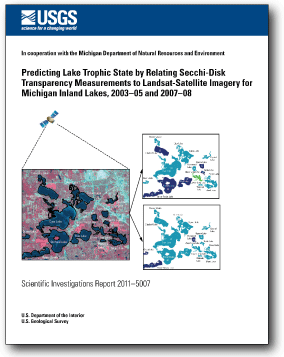
Inland lakes are an important economic and environmental resource for Michigan. The U.S. Geological Survey and the Michigan Department of Natural Resources and Environment have been cooperatively monitoring the quality of selected lakes in Michigan through the Lake Water Quality Assessment program. Sampling for this program began in 2001; by 2010, 730 of Michigan’s 11,000 inland lakes are expected to have been sampled once. Volunteers coordinated by the Michigan Department of Natural Resources and Environment began sampling lakes in 1974 and continue to sample (in 2010) approximately 250 inland lakes each year through the Michigan Cooperative Lakes Monitoring Program. Despite these sampling efforts, it still is impossible to physically collect measurements for all Michigan inland lakes; however, Landsat-satellite imagery has been used successfully in Minnesota, Wisconsin, Michigan, and elsewhere to predict the trophic state of unsampled inland lakes greater than 20 acres by producing regression equations relating in-place Secchi-disk measurements to Landsat bands. This study tested three alternatives to methods previously used in Michigan to improve results for predicted statewide Trophic State Index (TSI) computed from Secchi-disk transparency (TSI (SDT)). The alternative methods were used on 14 Landsat-satellite scenes with statewide TSI (SDT) for two time periods (2003–05 and 2007–08). Specifically, the methods were (1) satellite-data processing techniques to remove areas affected by clouds, cloud shadows, haze, shoreline, and dense vegetation for inland lakes greater than 20 acres in Michigan; (2) comparison of the previous method for producing a single open-water predicted TSI (SDT) value (which was based on an area of interest (AOI) and lake-average approach) to an alternative Gethist method for identifying open-water areas in inland lakes (which follows the initial satellite-data processing and targets the darkest pixels, representing the deepest water, before regression equations are created); and (3) checking to see whether the predicted TSI (SDT) values compared well between two regression equations, one previously used in Michigan and an alternative equation from the hydrologic literature. The combination of improved satellite-data processing techniques and the Gethist method to identify open-water areas in inland lakes during 2003–05 and 2007–08 provided a stronger relation and statistical significance between predicted TSI (SDT) and measured TSI than did the AOI lake-average method; differences in results for the two methods were significant at the 99-percent confidence level. With regard to the comparison of the regression equations, there were no statistically significant differences at the 95-percent confidence level between results from the two equations. The previously used equation, in combination with the Gethist method, yielded coefficient of determination (R2) values of 0.71 and 0.77 for the periods 2003–05 and 2007–08, respectively. The alternative equation, in combination with the Gethist method, yielded R2 values of 0.74 and 0.75 for 2003–05 and 2007–08, respectively. Predicted TSI (SDT) and measured TSI (SDT) values for lakes used in the regression equations compared well, with R2 values of 0.95 and 0.96 for predicted TSI (SDT) for 2003–05 and 2007–08, respectively. The R2 values for statewide predicted TSI (SDT) for all inland lakes with available open-water areas for 2003–05 and 2007–08 were 0.91 and 0.93, respectively. Although the two equations predicted similar trophic-state classes, the alternative equation is planned to be used for future prediction of TSI (SDT) values for Michigan inland lakes, to promote consistency in comparing predicted values between States and for potential use in trend analysis. |
First posted February 18, 2011 For additional information contact: Part or all of this report is presented in Portable Document Format (PDF); the latest version of Adobe Reader or similar software is required to view it. Download the latest version of Adobe Reader, free of charge. |
Fuller, L.M., Jodoin, R.S., and Minnerick, R.J., 2011, Predicting lake trophic state by relating Secchi-disk transparency measurements to Landsat-satellite imagery for Michigan inland lakes, 2003–05 and 2007–08: U.S. Geological Survey Scientific Investigations Report 2011–5007, 36 p.
Acknowledgments
Abstract
Introduction
Methods
Results
Summary and Conclusions
References Cited
Appendixes 1 and 2

![]() U.S. Department of the Interior |
U.S. Geological Survey
U.S. Department of the Interior |
U.S. Geological Survey
URL: http://
pubsdata.usgs.gov
/pubs/sir/2011/5007/index.html
Page Contact Information: USGS Publications Team
Page Last Modified: Thursday, 10-Jan-2013 20:04:31 EST
