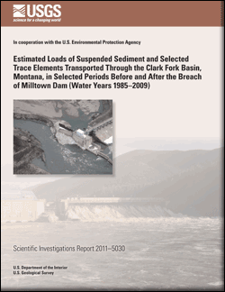
Scientific Investigations Report 2011–5030

Milltown Reservoir is a National Priorities List Superfund site in the upper Clark Fork basin of western Montana where sediments enriched in trace elements from historical mining and ore processing have been deposited since the completion of Milltown Dam in 1908. Milltown Dam was breached on March 28, 2008, as part of Superfund remediation activities to remove the dam and excavate contaminated sediment that had accumulated in Milltown Reservoir. In preparation for the breach of Milltown Dam, permanent drawdown of Milltown Reservoir began on June 1, 2006, and lowered the water-surface elevation by about 10 to 12 feet. After the breach of Milltown Dam, the water-surface elevation was lowered an additional 17 feet. Hydrologic data-collection activities were conducted by the U.S. Geological Survey in cooperation with U.S. Environmental Protection Agency to estimate loads of suspended sediment and trace elements transported through the Clark Fork basin before and after the breach of Milltown Dam. This report presents selected results of the data-collection activities. |
First posted April 7, 2011 For additional information contact: This report is presented in Portable Document Format (PDF); the latest version of Adobe Reader or similar software is required to view it. Download the latest version of Adobe Reader, free of charge. |
Sando, S.K., and Lambing, J.H., 2011, Estimated loads of suspended sediment and selected trace elements transported through the Clark Fork basin, Montana, in selected periods before and after the breach of Milltown Dam (water years 1985–2009): U.S. Geological Survey Scientific Investigations Report 2011–5030, 64 p.
Abstract
Introduction
Purpose and Scope
Description of the Study Area
Hydrologic Characteristics
Methods of Data Collection and Quality Assurance
Methods for Estimating Constituent Loads
Estimation of Constituent Loads for High-Intensity Stations
Suspended Sediment
Trace Elements
Estimation of Constituent Loads for Low-Intensity Stations
Estimated Loads Transported Through the Milltown Reservoir Project Area
Daily Loads
Suspended Sediment
Trace Elements
Annual Loads and Mass Balance
Estimated Loads Transported Through the Clark Fork Downstream from the Milltown Reservoir Project Area
Summary and Conclusions
Acknowledgments
References Cited
Supplement 1. Methods for Estimating Censored Concentrations for Water Year 2009 and Comparison with Methods Used in Previous Years
Supplement 2. Regression Equations for Estimating Suspended-Sediment and Trace-Element Discharge for the High-Intensity Stations
Supplement 3. Regression Equations for Estimating Suspended-Sediment and Trace-Element Discharge for the Low-Intensity Stations