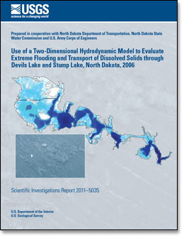
Scientific Investigations Report 2011–5035
AbstractThe U.S. Geological Survey in cooperation with the North Dakota Department of Transportation, North Dakota State Water Commission, and U.S. Army Corps of Engineers, developed a two-dimensional hydrodynamic model of Devils Lake and Stump Lake, North Dakota to be used as a hydrologic tool for evaluating the effects of different inflow scenarios on water levels, circulation, and the transport of dissolved solids through the lake. The numerical model, UnTRIM, and data primarily collected during 2006 were used to develop and calibrate the Devils Lake model. Performance of the Devils Lake model was tested using 2009 data. The Devils Lake model was applied to evaluate the effects of an extreme flooding event on water levels and hydrological modifications within the lake on the transport of dissolved solids through Devils Lake and Stump Lake. For the 2006 calibration, simulated water levels in Devils Lake compared well with measured water levels. The maximum simulated water level at site 1 was within 0.13 feet of the maximum measured water level in the calibration, which gives reasonable confidence that the Devils Lake model is able to accurately simulate the maximum water level at site 1 for the extreme flooding scenario. The timing and direction of winddriven fluctuations in water levels on a short time scale (a few hours to a day) were reproduced well by the Devils Lake model. For this application, the Devils Lake model was not optimized for simulation of the current speed through bridge openings. In future applications, simulation of current speed through bridge openings could be improved by more accurate definition of the bathymetry and geometry of select areas in the model grid. As a test of the performance of the Devils Lake model, a simulation of 2009 conditions from April 1 through September 30, 2009 was performed. Overall, errors in inflow estimates affected the results for the 2009 simulation; however, for the rising phase of the lakes, the Devils Lake model accurately simulated the faster rate of rise in Devils Lake than in Stump Lake, and timing and direction of wind-driven fluctuations in water levels on a short time scale were reproduced well. To help the U.S. Army Corps of Engineers determine the elevation to which the protective embankment for the city of Devils Lake should be raised, an extreme flooding scenario based on an inflow of one-half the probable maximum flood was simulated. Under the conditions and assumptions of the extreme flooding scenario, the water level for both lakes reached a maximum water level around 1,461.9 feet above the National Geodetic Vertical Datum of 1929. One factor limiting the extent of pumping from the Devils Lake State Outlet is sulfate concentrations in West Bay. If sulfate concentrations can be reduced in West Bay, pumping from the Devils Lake State Outlet potentially can increase. The Devils Lake model was used to simulate the transport of dissolved solids using specific conductance data as a surrogate for sulfate. Because the transport of dissolved solids was not calibrated, results from the simulations were not actual expected concentrations. However, the effects of hydrological modifications on the transport of dissolved solids could be evaluated by comparing the effects of hydrological modifications relative to a baseline scenario in which no hydrological modifications were made. Four scenarios were simulated: (1) baseline condition (no hydrological modification), (2) diversion of Channel A, (3) reduction of the area of water exchange between Main Bay and East Bay, and (4) combination of scenarios 2 and 3. Relative to scenario 1, mean concentrations in West Bay for scenarios 2 and 4 were reduced by approximately 9 percent. Given that there is no change in concentration for scenario 3, but about a 9-percent reduction in concentration for scenario 4, the diversion of Channel A was the only hydrologic modification that appeared to have the potential to reduce sulfate concentrations in West Bay. |
First posted April 26, 2011 For additional information contact: Part or all of this report is presented in Portable Document Format (PDF); the latest version of Adobe Reader or similar software is required to view it. Download the latest version of Adobe Reader, free of charge. |
Nustad, R.A., Wood,T.M., and Bales, J.D., 2011, Use of a two-dimensional hydrodynamic model to evaluate extreme flooding and transport of dissolved solids through Devils Lake and Stump Lake, North Dakota, 2006: U.S. Geological Survey Scientific Investigations Report 2011–5035, 33 p.
Abstract
Introduction
Methods of Data Collection
Hydrologic Conditions in Devils Lake For 2006
Two-Dimensional Hydrodynamic Model Development, Calibration, and Application
Summary
References Cited

![]() U.S. Department of the Interior |
U.S. Geological Survey
U.S. Department of the Interior |
U.S. Geological Survey
URL: http://pubsdata.usgs.gov/pubs/sir/2011/5035/index.html
Page Contact Information: GS Pubs Web Contact
Page Last Modified: Thursday, 10-Jan-2013 20:05:25 EST
