 Abstract
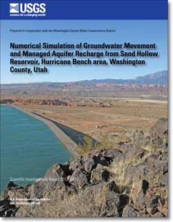
The Hurricane Bench area of Washington County, Utah, is a 70 square-mile area extending south from the Virgin River and encompassing Sand Hollow basin. Sand Hollow Reservoir, located on Hurricane Bench, was completed in March 2002 and is operated primarily as a managed aquifer recharge project by the Washington County Water Conservancy District. The reservoir is situated on a thick sequence of the Navajo Sandstone and Kayenta Formation. Total recharge to the underlying Navajo aquifer from the reservoir was about 86,000 acre-feet from 2002 to 2009. Natural recharge as infiltration of precipitation was approximately 16,800 acre-feet for the same period. Discharge occurs as seepage to the Virgin River, municipal and irrigation well withdrawals, and seepage to drains at the base of reservoir dams. Within the Hurricane Bench area, unconfined groundwater-flow conditions generally exist throughout the Navajo Sandstone. Navajo Sandstone hydraulic-conductivity values from regional aquifer testing range from 0.8 to 32 feet per day. The large variability in hydraulic conductivity is attributed to bedrock fractures that trend north-northeast across the study area.
A numerical groundwater-flow model was developed to simulate groundwater movement in the Hurricane Bench area and to simulate the movement of managed aquifer recharge from Sand Hollow Reservoir through the groundwater system. The model was calibrated to combined steady- and transient-state conditions. The steady-state portion of the simulation was developed and calibrated by using hydrologic data that represented average conditions for 1975. The transient-state portion of the simulation was developed and calibrated by using hydrologic data collected from 1976 to 2009. Areally, the model grid was 98 rows by 76 columns with a variable cell size ranging from about 1.5 to 25 acres. Smaller cells were used to represent the reservoir to accurately simulate the reservoir bathymetry and nearby monitoring wells; larger cells were used in the northern and southern portions of the model where water-level data were limited. Vertically, the aquifer system was divided into 10 layers, which incorporated the Navajo Sandstone and Kayenta Formation. The model simulated recharge to the groundwater system as natural infiltration of precipitation and as infiltration of managed aquifer recharge from Sand Hollow Reservoir. Groundwater discharge was simulated as well withdrawals, shallow drains at the base of reservoir dams, and seepage to the Virgin River. During calibration, variables were adjusted within probable ranges to minimize differences among model-simulated and observed water levels, groundwater travel times, drain discharges, and monthly estimated reservoir recharge. In general, the model adequately simulated water levels, and most simulated water levels were within 10 ft of measured water levels. Simulated arrival times of environmental tracers were within the range of observed arrivals at nearby monitoring wells from 2003 to 2008. The total simulated drain discharge from 2002 to 2009 was 9,500 acre-ft. The total simulated recharge from Sand Hollow Reservoir between 2002 and 2009 was approximately 94,000 acre-ft. Predictive modeling revealed an average travel time of 800 years from 2009 for water recharged in Sand Hollow Reservoir to reach the Virgin River, with the earliest arrival occuring in 500 years.
|
First posted December 18, 2012
Part or all of this report is presented in Portable Document Format (PDF); the latest version of Adobe Reader or similar software is required to view it. Download the latest version of Adobe Reader, free of charge. |

