Scientific Investigations Report 2012–5261
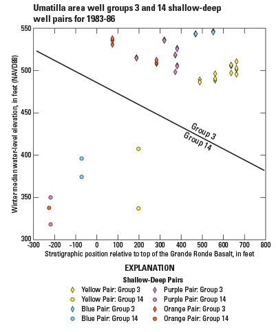
Figure 13. Stratigraphic position (distance from the well bottom to the simulated top of Grande Ronde Basalt) compared with winter median water level measured in wells for shallow–deep well pairs from groups 3 and 14 near the Oregon Water Resources Department administrative areas in the Umatilla Basin, Oregon. Colors of points correspond to colors of shallow-deep pair circles in figure 10. |
First posted February 5, 2013 For additional information contact: Part or all of this report is presented in Portable Document Format (PDF); the latest version of Adobe Reader or similar software is required to view it. Download the latest version of Adobe Reader, free of charge. |

![]() U.S. Department of the Interior |
U.S. Geological Survey
U.S. Department of the Interior |
U.S. Geological Survey
URL: http://pubsdata.usgs.gov/pubs/sir/2012/5261/figure13.html
Page Contact Information: GS Pubs Web Contact
Page Last Modified: Thursday, 17-Jan-2013 15:31:16 EST
