 Abstract Abstract
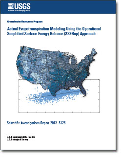
Remote-sensing technology and surface-energy-balance methods can provide accurate and repeatable estimates of actual evapotranspiration (ETa) when used in combination with local weather datasets over irrigated lands. Estimates of ETa may be used to provide a consistent, accurate, and efficient approach for estimating regional water withdrawals for irrigation and associated consumptive use (CU), especially in arid cropland areas that require supplemental water due to insufficient natural supplies from rainfall, soil moisture, or groundwater. ETa in these areas is considered equivalent to CU, and represents the part of applied irrigation water that is evaporated and/or transpired, and is not available for immediate reuse. A recent U.S. Geological Survey study demonstrated the application of the remote-sensing-based Simplified Surface Energy Balance (SSEB) model to estimate 10-year average ETa at 1-kilometer resolution on national and regional scales, and compared those ETa values to the U.S. Geological Survey’s National Water-Use Information Program’s 1995 county estimates of CU. The operational version of the operational SSEB (SSEBop) method is now used to construct monthly, county-level ETa maps of the conterminous United States for the years 2000, 2005, and 2010. The performance of the SSEBop was evaluated using eddy covariance flux tower datasets compiled from 2005 datasets, and the results showed a strong linear relationship in different land cover types across diverse ecosystems in the conterminous United States (correlation coefficient [r] ranging from 0.75 to 0.95). For example, r for
- woody savannas (0.75),
- grassland (0.75),
- forest (0.82),
- cropland (0.84),
- shrub land (0.89), and
- urban (0.95).
A comparison of the remote-sensing SSEBop method for estimating ETa and the Hamon temperature method for estimating potential ET (ETp) also was conducted, using regressions of all available county averages of ETa for 2005 and 2010, and yielded correlations of r = 0.60 and r = 0.71, respectively. Correlations generally are stronger in the Southeast where ETa is close to ETp. SSEBop ETa provides more spatial detail and accuracy in the Southwest where irrigation is practiced in a smaller proportion of the region.
|
First posted July 2, 2013
Part or all of this report is presented in Portable Document Format (PDF); the latest version of Adobe Reader or similar software is required to view it. Download the latest version of Adobe Reader, free of charge. |

