 Abstract Abstract
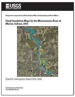
Digital flood-inundation maps for a 9-mile (mi) reach of the Mississinewa River from 0.75 mi upstream from the Pennsylvania Street bridge in Marion, Indiana, to 0.2 mi downstream from State Route 15 were created by the U.S. Geological Survey (USGS) in cooperation with the Indiana Office of Community and Rural Affairs. The flood inundation maps, which can be accessed through the USGS Flood Inundation Mapping Science Web site at http://water.usgs.gov/osw/flood_inundation, depict estimates of the areal extent and depth of flooding corresponding to selected water levels (stages) at the USGS streamgage on the Mississinewa River at Marion (station number 03326500). Near-real-time stages at this streamgage may be obtained on the Internet from the USGS National Water Information System at http://waterdata.usgs.gov/ or the National Weather Service (NWS) Advanced Hydrologic Prediction Service at http://water.weather.gov/ahps/, which also forecasts flood hydrographs at this site.
Flood profiles were computed for the stream reach by means of a one-dimensional step-backwater model. The model was calibrated by using the current stage-discharge relation at the Mississinewa River streamgage, in combination with water-surface profiles from historic floods and from the current (2002) flood-insurance study for Grant County, Indiana. The hydraulic model was then used to compute seven water-surface profiles for flood stages at 1-fo (ft) intervals referenced to the streamgage datum and ranging from 10 ft, which is near bankfull, to 16 ft, which is between the water levels associated with the estimated 10- and 2-percent annual exceedance probability floods (floods with recurrence interval between 10 and 50 years) and equals the “major flood stage” as defined by the NWS. The simulated water-surface profiles were then combined with a Geographic Information System digital elevation model (derived from light detection and ranging (lidar) data having a 0.98 ft vertical accuracy and 4.9 ft horizontal resolution) to delineate the area flooded at each water level.
The availability of these maps, along with Internet information regarding current stage from the USGS streamgage and forecasted high-flow stages from the NWS, will provide emergency management personnel and residents with information that is critical for flood response activities such as evacuations and road closures, as well as for post-flood recovery efforts.
|
First posted April 21, 2014
Part or all of this report is presented in Portable Document Format (PDF). For best results viewing and printing PDF documents, it is recommended that you download the documents to your computer and open them with Adobe Reader. PDF documents opened from your browser may not display or print as intended. Download the latest version of Adobe Reader, free of charge.
|

