 Abstract
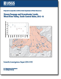
Stream discharge and water levels in wells were measured at multiple sites in the Wood River Valley, south-central Idaho, in August 2012, October 2012, and March 2013, as a component of data collection for a groundwater-flow model of the Wood River Valley aquifer system. This model is a cooperative and collaborative effort between the U.S. Geological Survey and the Idaho Department of Water Resources.
Stream-discharge measurements for determination of seepage were made during several days on three occasions: August 27–28, 2012, October 22–24, 2012, and March 27–28, 2013. Discharge measurements were made at 49 sites in August and October, and 51 sites in March, on the Big Wood River, Silver Creek, their tributaries, and nearby canals.
The Big Wood River generally gains flow between the Big Wood River near Ketchum streamgage (13135500) and the Big Wood River at Hailey streamgage (13139510), and loses flow between the Hailey streamgage and the Big Wood River at Stanton Crossing near Bellevue streamgage (13140800). Shorter reaches within these segments may differ in the direction or magnitude of seepage or may be indeterminate because of measurement uncertainty. Additional reaches were measured on Silver Creek, the North Fork Big Wood River, Warm Springs Creek, Trail Creek, and the East Fork Big Wood River. Discharge measurements also were made on the Hiawatha, Cove, District 45, Glendale, and Bypass Canals, and smaller tributaries to the Big Wood River and Silver Creek.
Water levels in 93 wells completed in the Wood River Valley aquifer system were measured during October 22–24, 2012; these wells are part of a network established by the U.S. Geological Survey in 2006. Maps of the October 2012 water-table altitude in the unconfined aquifer and the potentiometric-surface altitude of the confined aquifer have similar topology to those on maps of October 2006 conditions.
Between October 2006 and October 2012, water-table altitude in the unconfined aquifer rose by as much as 1.86 feet in 6 wells and declined by as much as 14.28 feet in 77 wells; average decline was 2.9 feet. A map of changes in the water‑table altitude of the unconfined aquifer shows that the largest declines were in tributary canyons and in an area roughly between Baseline and Glendale Roads.
From October 2006 to October 2012, the potentiometric-surface altitude in 10 wells completed in the confined aquifer declined between 0.12 and 20.50 feet; average decline was 6.8 feet. A map of changes in the potentiometric-surface altitude of the confined aquifer shows that the largest declines were in the southwestern part of the Bellevue fan.
Reduced precipitation prior to the October 2012 water-level measurements likely is partially responsible for 2006–12 water-table declines in the unconfined aquifer; the relative contribution of precipitation deficit and groundwater withdrawals to the declines is not known. Although the confined aquifer may not receive direct recharge from precipitation or streams, groundwater withdrawal from the confined aquifer induces flow from the unconfined aquifer. Declines in the confined aquifer are likely due to groundwater withdrawals and declines in the water table of the unconfined aquifer. A statistical analysis of five long-term monitoring wells (three completed in the unconfined aquifer, one in the confined aquifer, and one outside the aquifer system boundary) showed statistically significant declining trends in four wells.

