Techniques and Methods 2–H1
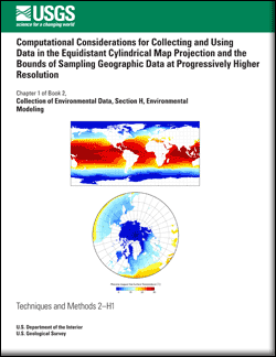
AbstractThe Equidistant Cylindrical Map projection is popular with digital modelers and others for storing and processing worldwide data sets because of the simple association of latitude and longitude to cell values or pixels in the resulting grid. This projection does not accurately display area, and the diminished geographic area represented by cells at high latitudes is not often carefully considered. A simple mathematical analysis quantifies the discrepancy in area sampled by cells at different latitudes. The presence of this discrepancy indicates that the use of this projection can induce bias in data sets when both sampling and reporting data. It is demonstrated that as the resolution requirements of input data for models increase, the necessity of providing data to accurately describe smaller cells, particularly at high latitude, will be a challenge. |
First posted May 20, 2011 For additional information contact: Part or all of this report is presented in Portable Document Format (PDF); the latest version of Adobe Reader or similar software is required to view it. Download the latest version of Adobe Reader, free of charge. |
Foley, K.M., 2011, Computational considerations for collecting and using data in the equidistant cylindrical map projection and the bounds of sampling geographic data at progressively higher resolution: U.S. Geological Survey Techniques and Methods 2—H1, 5 p.
Abstract
Introduction
Analysis
Conclusions
References

![]() U.S. Department of the Interior |
U.S. Geological Survey
U.S. Department of the Interior |
U.S. Geological Survey
URL: http://pubsdata.usgs.gov/pubs/tm/tm2h1/index.html
Page Contact Information: GS Pubs Web Contact
Page Last Modified: Friday, 02-Dec-2016 15:50:14 EST
