|
|
|
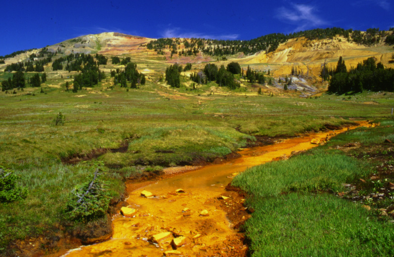
Cover Photograph: Headwaters of Daisy Creek in the New World Mining District near Yellowstone National Park, Montana. The McLaren Mine is on the right and Fisher Mountain is on the left in the background. View is upstream from sampling site 1,340 and shows the upstream, low-gradient part of the study reach. Photograph by J.H. Lambing, U.S. Geological Survey. |
Home page for USGS Water Resources Investigations Report 00-4261
| AccessibilityFOIAPrivacyPolicies and Notices | |
 |
|