Hydrogeologic Framework of Antelope Valley and Bedell Flat, Washoe County, West-Central Nevada
Plate 1. Hydrogeologic Framework of Antelope Valley and Bedell Flat
Plate 1 can be viewed as pair of JPEG images or as a PDF file.
The JPEG version consists of a map and accompanying explanation of the colors and symbols used in the map. The map, a 292K file, measures 11 by 17 inches. The map explanation, a 227K file, measures 11 by 19 inches.
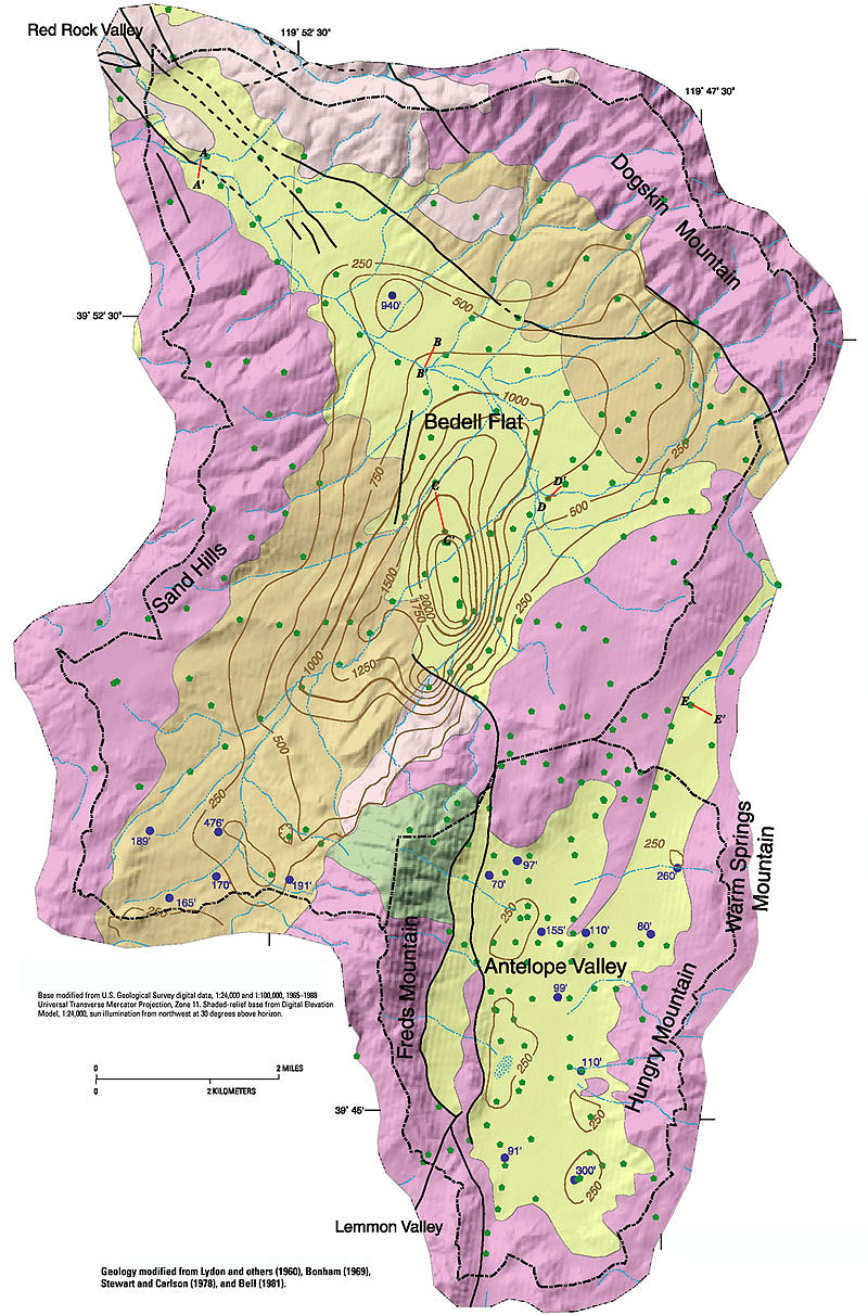
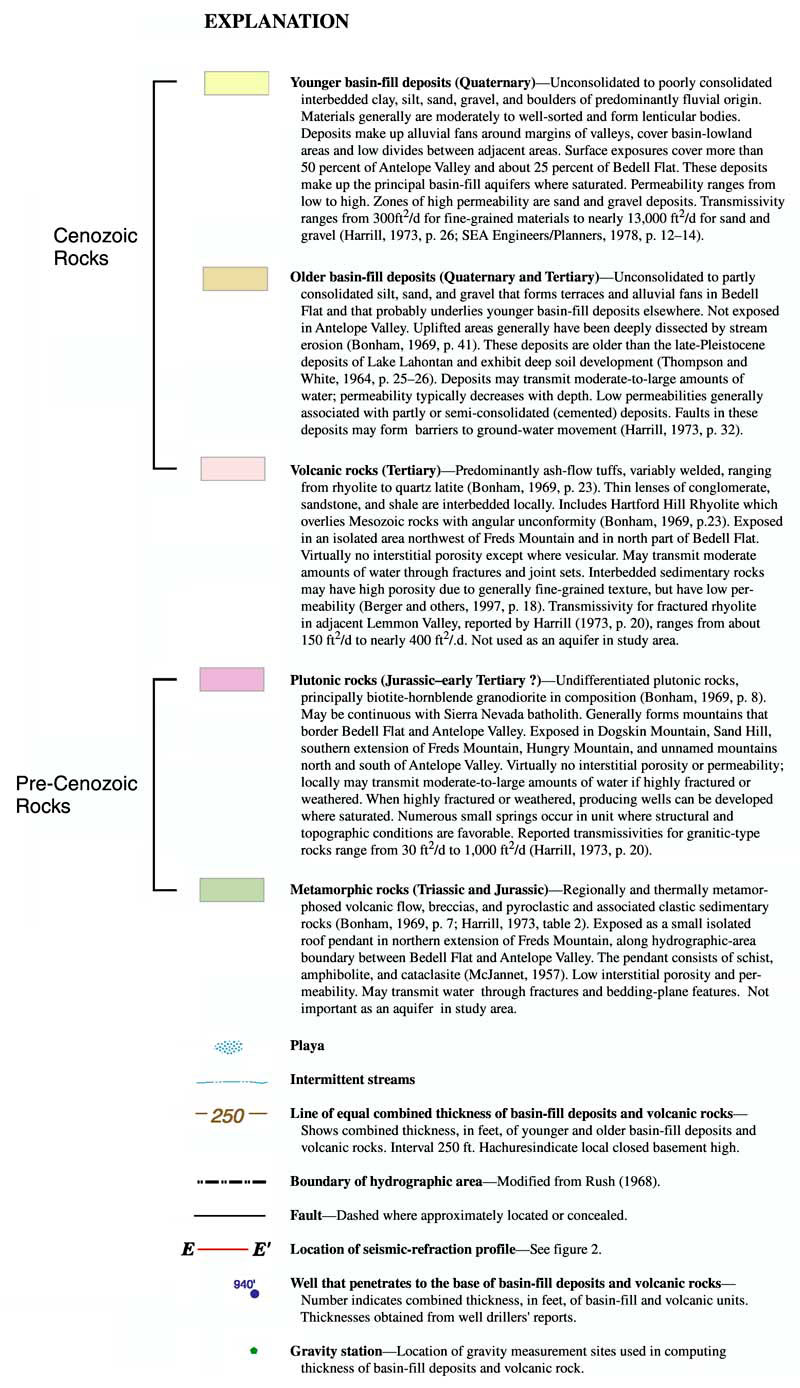
If you have Adobe Acrobat Reader loaded as a plug-in to your browser, you can view Plate 1 as a 1,891K PDF file, which contains both the map and explanation (Download free copy of Adobe Acrobat Reader.)
Table of Contents | Return to Home Page