|
|
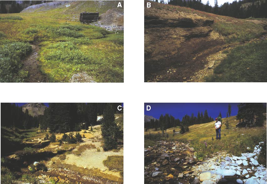
Figure 8. Possible sources of metals to Miller Creek, Montana: A. The Black Warrior Mine located in the upper study reach. B. A natural ferricrete deposit adjacent to Miller Creek, near site 1,850. C. Mine waste at Miller Creek dump 1. D. Left-bank inflow (site 6,465), with aluminum staining near the middle of the study reach. This inflow had the highest total-recoverable copper concentration of any site sampled in the Miller Creek watershed during this study. Photographs by D.A. Nimick. |
|
Home page for USGS Water Resources Investigations Report 02-4148
|
| AccessibilityFOIAPrivacyPolicies and Notices | |
 |
|