Water-Resources Investigations Report 80-689
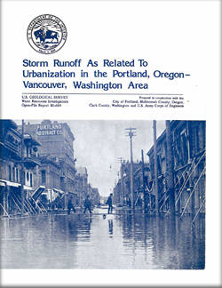
A series of equations was developed to provide a better method of determining flood frequencies in the Portland-Vancouver urban area than is now available. The resulting regression equations can be used to compute peak discharge and storm runoff with a standard error of estimate of approximately 30 percent. Basins used to define the regression equations ranged in size from 0.2 to 26 square miles. Those physical basin parameters that proved to be significant are: drainage area, effective impervious area, storage, rainfall intensity, basin slope, and soil infiltration. The equations indicate that total urbanization of an undeveloped basin can increase peak discharge as much as 3½ times and almost double the volume of storm runoff. Impervious area, as delineated by mapping techniques, proved to be an inadequate physical parameter for use in the regression equations because builders and planners have devised many methods of routing storm runoff from impervious areas to the main channel (in effect, speeding up or slowing down the response to the storm). In some parts of the study area, storm runoff was diverted into dry wells and never entered the main channel. To define the effect of this rerouting, the digital model was used to find an effective impervious area that would "best fit" the rainfall-runoff data. Field estimates to verify the effectiveness of the impervious area for two of the basins showed that optimizations were within 20 percent of those shown by the digital model. Users of these data who may find the effective impervious area a difficult, expensive, and time-consuming parameter to obtain have an alternative. The combination of land-use type I (parks, forests, and vacant lots) and Type II (agriculture) proved to be an excellent inverse indicator of impervious area. Land-use types I and II, coupled with the street-gutter density, an indication of effective routing, provide the user with alternative indices of urbanization. |
Part or all of this report is presented in Portable Document Format (PDF); the latest version of Adobe Reader or similar software is required to view it. Download the latest version of Adobe Reader, free of charge. |
Laenen, Antonius, 1980, Storm runoff as related to urbanization in the Portland, Oregon-Vancouver, Washington Area: U.S. Geological Survey Water-Resources Investigations 80-689, 71 p., 1 plate.
Conversion factors
Glossary
Abstract
Introduction
Physical setting
Rainfall characteristics
Data-collection methods
Description of the hydrologic analyses used
Uniqueness of selected basins
Regionalization of flood-peak and storm-runoff characteristics
Assessment of peak discharges for historic extremes prior to period of study
Conclusions
Selected references

![]() U.S. Department of the Interior |
U.S. Geological Survey
U.S. Department of the Interior |
U.S. Geological Survey
URL: http://pubsdata.usgs.gov/pubs/wri/wri80-689/index.html
Page Contact Information: GS Pubs Web Contact
Page Last Modified: Wednesday, 07-Dec-2016 13:38:32 EST
