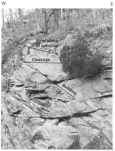
Figure 20.
Overturned anticline in the Harpers Formation(
-Ch
) showing bedding and cleavage relations in the Harpers Ferry National Historical Park along the Shenandoah River (pl. 1). Height of outcrop is approximately 15 m.
U.S. Geological Survey
,
U.S. Department of the Interior
This page is https://pubs.usgs.gov/bulletin/b2123/figure20.html
Contact:
Scott Southworth
Last modified 08.29.00