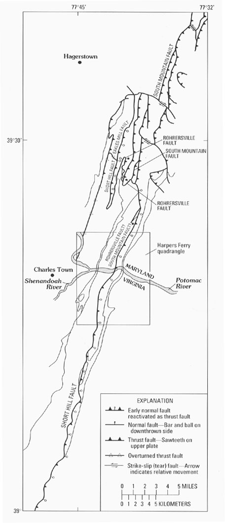
Figure 22. Structural map showing the relation of the Short Hill fault (Southworth, 1993) to faults mapped by Brezinski in Maryland. The Eakles Mill and Rohrersville faults were mapped by Brezinski (1992), and the South Mountain fault was mapped by Brezinski and others (1991) and Brezinski (1992).