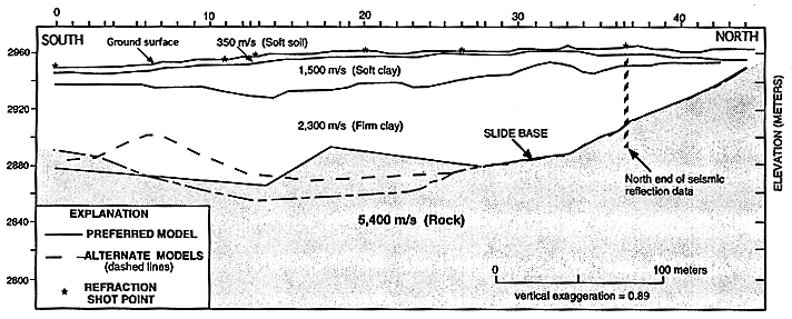
Figure 4.-- Refraction data interpretation showing the topography of the ground surface, the four distinct seismic-velocity layers, and the alternate refraction models. The vertical tic marks on the horizontal axis at the top of the figure show the true positions of the geophone stations and shotpoints. Asterisks mark the shotpoint positions on the ground surface.

![]() U.S. Department of the Interior |
U.S. Geological Survey
U.S. Department of the Interior |
U.S. Geological Survey
URL: http://pubsdata.usgs.gov/pubs/bul/b2130/ch13fig4.htm
Page Contact Information: GS Pubs Web Contact
Page Last Modified: Friday, 23-Mar-2012 14:25:17 EDT