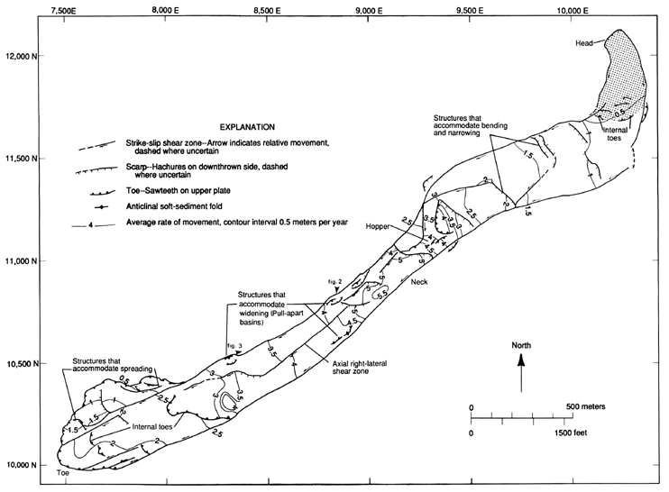
Figure 1.--Primary surface features, kinematic elements, and mean annual rate of displacement of the Slumgullion landslide. Structures were mapped in the field, spring and autumn 1993, and simplified from our original 1:1000-scale field maps. Rates were computed from our field measurements, 1991-93, and from photogrammetric measurements of aerial photographs made in 1985 and 1990 (Smith, 1993). Displacement changes abruptly across several of the scarps, shear zones, and internal toes, particularly near the narrowest part of the landslide. Local grid coordinates are from Varnes and others (1993).

![]() U.S. Department of the Interior |
U.S. Geological Survey
U.S. Department of the Interior |
U.S. Geological Survey
URL: http://pubsdata.usgs.gov/pubs/bul/b2130/ch2fig1.htm
Page Contact Information: GS Pubs Web Contact
Page Last Modified: Friday, 23-Mar-2012 14:25:13 EDT