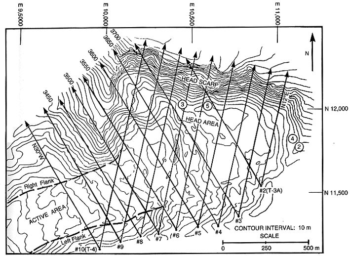
Figure 6.-- Map showing locations of nine permanent camera stations from which stereopairs (fig. 7) were taken at bearings of N. 12E E. and N. 30E W. in September 1992. Approximate camera positions for photographs in figures 2, 3, 4, and 5 are indicated by circled numbers. Grid ticks on map borders represent local coordinate system in meters.

![]() U.S. Department of the Interior |
U.S. Geological Survey
U.S. Department of the Interior |
U.S. Geological Survey
URL: http://pubsdata.usgs.gov/pubs/bul/b2130/ch4fig6.htm
Page Contact Information: GS Pubs Web Contact
Page Last Modified: Friday, 23-Mar-2012 14:25:09 EDT