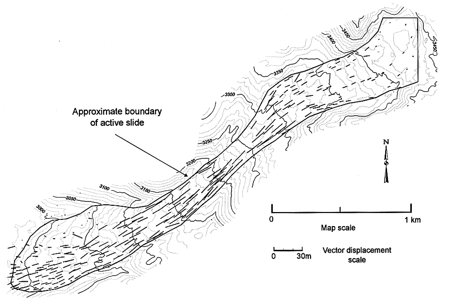
Figure 1.-- Map of active part of the Slumgullion landslide showing vectors of horizontal displacement between 1985 and 1990. Topographic contour interval is 10 m. All vectors are directed downslope, from upper right to lower left.

![]() U.S. Department of the Interior |
U.S. Geological Survey
U.S. Department of the Interior |
U.S. Geological Survey
URL: http://pubsdata.usgs.gov/pubs/bul/b2130/ch9fig1.htm
Page Contact Information: GS Pubs Web Contact
Page Last Modified: Friday, 23-Mar-2012 14:24:52 EDT