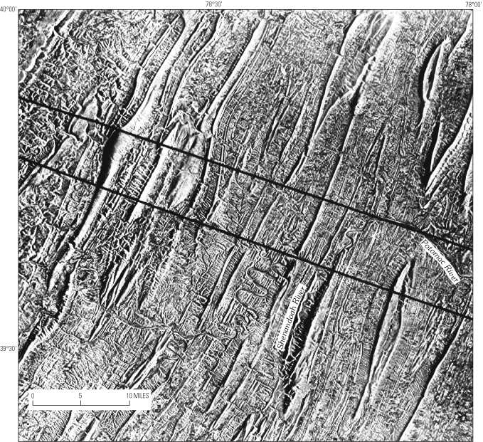
Figure 16. Side-looking airborne radar (SLAR) image of part of the Cumberland 1°x2° quadrangle showing the narrowing of folds to the south across the Pennsylvania-Maryland-West Virginia lateral ramp (area within the crosscutting parallel lines).
|
Figure 16. Side-looking airborne radar (SLAR) image of part of the Cumberland 1°x2° quadrangle showing the narrowing of folds to the south across the Pennsylvania-Maryland-West Virginia lateral ramp (area within the crosscutting parallel lines). |
This page is https://pubs.usgs.gov/bulletin/b2163/html/fig16.html
Maintained by Eastern Publications Group Web Team
Last updated 02.15.01 (krw)