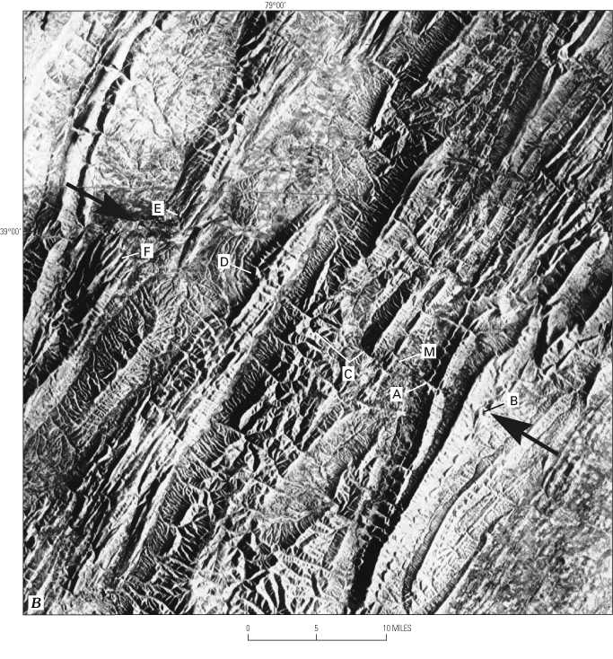
Figure 20B. Side-looking airborne radar (SLAR) images of parts of the Cumberland and Charlottesville 1°x2° quadrangles showing the boundary lines enclosing the Mathias lateral ramp. East-west line across image is a mosaic line. Inset from right-center of A. Heavy arrows mark the Mathias lateral ramp. Key features are as follows: A and B, offsets of ridges underlain by Oriskany Sandstone, illustrating the topographic discontinuities along the northern hinge of the ramp; C, wind and water gaps; D, inflection and landslide in Elk Mountain anticline; E and F, termination of subsidiary anticlines. M, Mathias, W. Va. Scene is approximately 34 mi wide. From Pohn and others (1985).