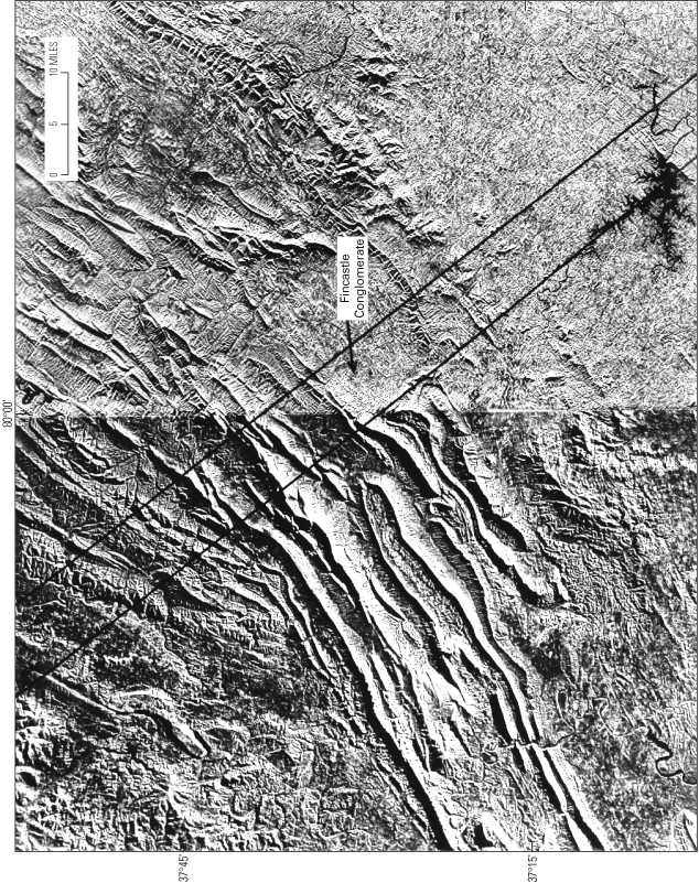
Figure 26. Side-looking airborne radar (SLAR) image showing the junction of the central and southern Appalachians along the Roanoke lateral ramp (between parallel lines).
|
Figure 26. Side-looking airborne radar (SLAR) image showing the junction of the central and southern Appalachians along the Roanoke lateral ramp (between parallel lines). |
This page is https://pubs.usgs.gov/bulletin/b2163/html/fig26.html
Maintained by Eastern Publications Group Web Team
Last updated 02.15.01 (krw)