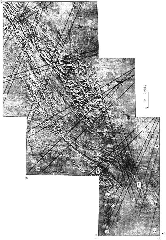
Figure 27A. Side-looking airborne radar (SLAR) composite image of the southern Appalachians showing locations of inferred lateral ramps. Abbreviations are as follows: N, New River; B, Blacksburg; J, Johnson City; P, Pulaski; K, Kingsport; KV, Knoxville; S, Sequatchie Valley; R, Rising Fawn; G, Gadsden; C, Calhoun; PM, Piedmont; A, Anniston; BH, north edge of Birmingham ramp.