Figure 27B - Side-looking airborne radar composite image of the southern Appalachians showing locations of inferred lateral ramps. Same image as A but uninterpreted.

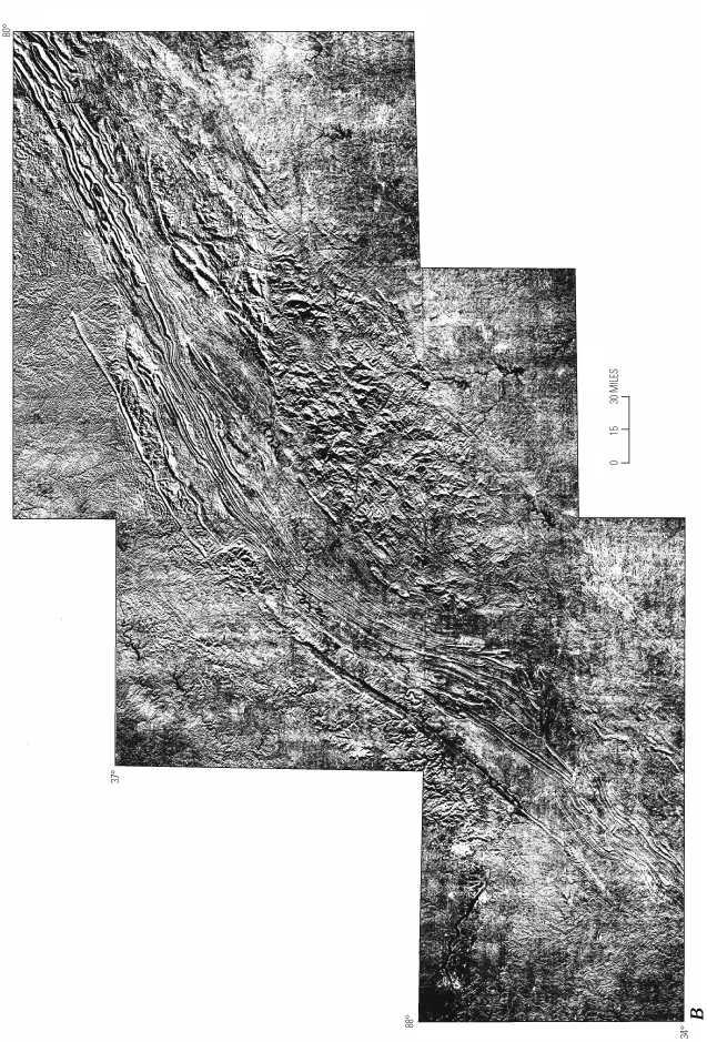
Figure 27 B. Same image as A but uninterpreted.


To return to U.S. Geological Bulletin 2163, close window.

This page is https://pubs.usgs.gov/bulletin/b2163/html/fig27b.html
Maintained by Eastern Publications Group Web Team
Last updated 02.15.01 (krw)