Figure 36 - Map showing relationship between lateral ramps and earthquakes in the eastern United States

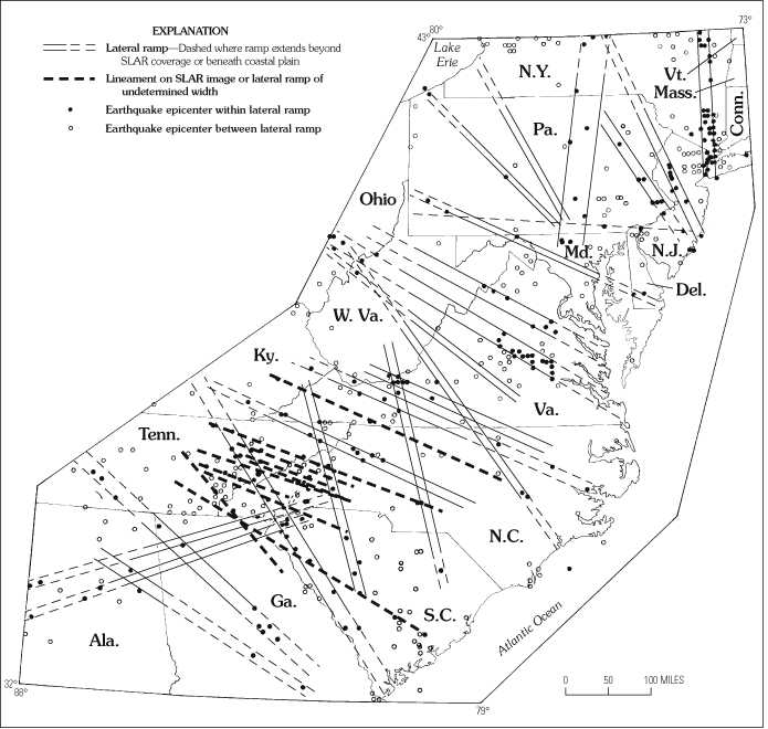
Figure 36. Map showing relationship between lateral ramps and earthquakes in the eastern United States. See figure 30 for ramp names. Earthquake data are from Earth Technology Corporation (written commun., 1984). Modified from Pohn and Coleman (1991).


To return to U.S. Geological Bulletin 2163, close window.

This page is https://pubs.usgs.gov/bulletin/b2163/html/fig36.html
Maintained by Eastern Publications Group Web Team
Last updated 02.15.01 (krw)