Figure 40 - Side-looking airborne radar image of a part of Papua New Guinea showing change in fold wavelength along which volcanoes are aligned

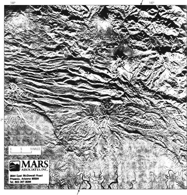
Figure 40. Side-looking airborne radar (SLAR) image of a part of Papua New Guinea showing change in fold wavelength along which volcanoes are aligned. Inferred lateral ramp is marked by arrows. Illumination is from south. Image courtesy of MARS Associates (Phoenix, Ariz.).


To return to U.S. Geological Bulletin 2163, close window.

This page is https://pubs.usgs.gov/bulletin/b2163/html/fig40.html
Maintained by Eastern Publications Group Web Team
Last updated 02.15.01 (krw)